

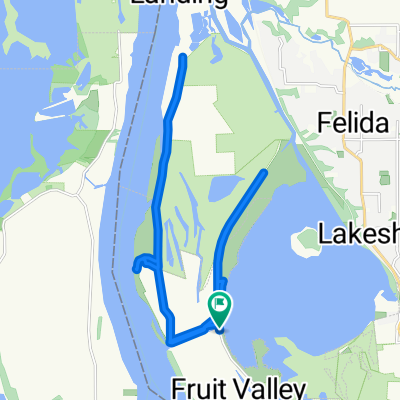
10316 NW 15th Ave, Vancouver to 4040 Plomondon St, Vancouver
A cycling route starting in Lake Shore, Washington, United States.
Overview
About this route
- 36 min
- Duration
- 10.8 km
- Distance
- 93 m
- Ascent
- 109 m
- Descent
- 17.9 km/h
- Avg. speed
- ---
- Max. altitude

Route quality
Waytypes & surfaces along the route
Waytypes
Road
4.8 km
(44 %)
Path
2.6 km
(24 %)
Surfaces
Paved
3.8 km
(35 %)
Paved (undefined)
2.6 km
(24 %)
Asphalt
1.1 km
(10 %)
Undefined
7.1 km
(65 %)
Continue with Bikemap
Use, edit, or download this cycling route
You would like to ride 10316 NW 15th Ave, Vancouver to 4040 Plomondon St, Vancouver or customize it for your own trip? Here is what you can do with this Bikemap route:
Free features
- Save this route as favorite or in collections
- Copy & plan your own version of this route
- Sync your route with Garmin or Wahoo
Premium features
Free trial for 3 days, or one-time payment. More about Bikemap Premium.
- Navigate this route on iOS & Android
- Export a GPX / KML file of this route
- Create your custom printout (try it for free)
- Download this route for offline navigation
Discover more Premium features.
Get Bikemap PremiumFrom our community
Other popular routes starting in Lake Shore
 Recovered Route
- Distance
- 5.9 km
- Ascent
- 43 m
- Descent
- 27 m
- Location
- Lake Shore, Washington, United States
 Burnt Bridge Creek Greenway Trail, Vancouver to 2707 NW Leadbetter Pkwy, Camas
- Distance
- 26.1 km
- Ascent
- 199 m
- Descent
- 110 m
- Location
- Lake Shore, Washington, United States
 7007–7009 NW Lakeshore Ave, Vancouver to 6794–6798 NW Bernie Dr, Vancouver
- Distance
- 11.9 km
- Ascent
- 121 m
- Descent
- 121 m
- Location
- Lake Shore, Washington, United States
 5599 NW Lower River Rd, Vancouver to 5599 NW Lower River Rd, Vancouver
- Distance
- 27.1 km
- Ascent
- 13 m
- Descent
- 19 m
- Location
- Lake Shore, Washington, United States
 5599 NW Lower River Rd, Vancouver to 5599 NW Lower River Rd, Vancouver
- Distance
- 24.8 km
- Ascent
- 3 m
- Descent
- 9 m
- Location
- Lake Shore, Washington, United States
 6933–6999 NW Fruit Valley Rd, Vancouver to 6700–6786 NW Bernie Dr, Vancouver
- Distance
- 25.7 km
- Ascent
- 32 m
- Descent
- 58 m
- Location
- Lake Shore, Washington, United States
 training pt2
- Distance
- 24.6 km
- Ascent
- 246 m
- Descent
- 245 m
- Location
- Lake Shore, Washington, United States
 6788–6792 NW Bernie Dr, Vancouver to 6700–6786 NW Bernie Dr, Vancouver
- Distance
- 25.4 km
- Ascent
- 216 m
- Descent
- 217 m
- Location
- Lake Shore, Washington, United States
Open it in the app