

Overview
About this route
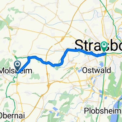
Molsheim - Marckolsheim
- -:--
- Duration
- 75 km
- Distance
- 52 m
- Ascent
- 58 m
- Descent
- ---
- Avg. speed
- ---
- Max. altitude

Part of
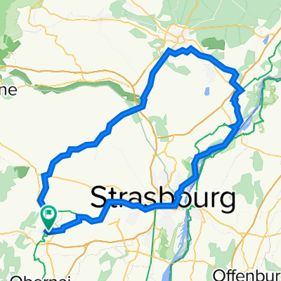
Tour d'Alsace
4 stages
Route quality
Waytypes & surfaces along the route
Waytypes
Cycleway
50.2 km
(67 %)
Path
23.2 km
(31 %)
Surfaces
Paved
74.2 km
(99 %)
Asphalt
72 km
(96 %)
Paved (undefined)
2.2 km
(3 %)
Undefined
0.7 km
(1 %)
Continue with Bikemap
Use, edit, or download this cycling route
You would like to ride Alsace - Etape 3 or customize it for your own trip? Here is what you can do with this Bikemap route:
Free features
- Save this route as favorite or in collections
- Copy & plan your own version of this route
- Sync your route with Garmin or Wahoo
Premium features
Free trial for 3 days, or one-time payment. More about Bikemap Premium.
- Navigate this route on iOS & Android
- Export a GPX / KML file of this route
- Create your custom printout (try it for free)
- Download this route for offline navigation
Discover more Premium features.
Get Bikemap PremiumFrom our community
Other popular routes starting in Molsheim
 piste cyclable
- Distance
- 23 km
- Ascent
- 249 m
- Descent
- 303 m
- Location
- Molsheim, Grand Est, France
 Molsheim - Vesting Kaiser Wilhelm
- Distance
- 13.4 km
- Ascent
- 163 m
- Descent
- 162 m
- Location
- Molsheim, Grand Est, France
 Mont Saint Odile (route) - Tour
- Distance
- 84.7 km
- Ascent
- 1,547 m
- Descent
- 1,544 m
- Location
- Molsheim, Grand Est, France
 Molsheim Gare -Fegersheim Aller-Retour
- Distance
- 34 km
- Ascent
- 35 m
- Descent
- 49 m
- Location
- Molsheim, Grand Est, France
 Molsheim 55km - Autour (route)
- Distance
- 55.3 km
- Ascent
- 577 m
- Descent
- 577 m
- Location
- Molsheim, Grand Est, France
 Haguenau
- Distance
- 112.7 km
- Ascent
- 605 m
- Descent
- 604 m
- Location
- Molsheim, Grand Est, France
 Sarrebourg (Phalsbourg Saverne)
- Distance
- 135.7 km
- Ascent
- 1,540 m
- Descent
- 1,538 m
- Location
- Molsheim, Grand Est, France
 140729, 8. Etappe, Molsheim-Sarrebourg
- Distance
- 80.2 km
- Ascent
- 745 m
- Descent
- 664 m
- Location
- Molsheim, Grand Est, France
Open it in the app