

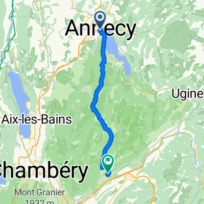
2e étape : Annecy-Semnoz-Annecy
A cycling route starting in Annecy, Auvergne-Rhône-Alpes, France.
Overview
About this route
Riders will face the tough climb of Semnoz (17.4 km with the last 11 km at 8.5%) before descending towards Sevrier and enjoying a fairly peaceful stage finish along Lake Annecy, except for the short wall at Talloires near the end of the route.
- -:--
- Duration
- 78 km
- Distance
- 1,370 m
- Ascent
- 1,369 m
- Descent
- ---
- Avg. speed
- ---
- Max. altitude
Route photos


Route quality
Waytypes & surfaces along the route
Waytypes
Cycleway
20.3 km
(26 %)
Quiet road
2.3 km
(3 %)
Surfaces
Paved
76.4 km
(98 %)
Asphalt
75.7 km
(97 %)
Concrete
0.8 km
(1 %)
Undefined
1.6 km
(2 %)
Continue with Bikemap
Use, edit, or download this cycling route
You would like to ride 2e étape : Annecy-Semnoz-Annecy or customize it for your own trip? Here is what you can do with this Bikemap route:
Free features
- Save this route as favorite or in collections
- Copy & plan your own version of this route
- Sync your route with Garmin or Wahoo
Premium features
Free trial for 3 days, or one-time payment. More about Bikemap Premium.
- Navigate this route on iOS & Android
- Export a GPX / KML file of this route
- Create your custom printout (try it for free)
- Download this route for offline navigation
Discover more Premium features.
Get Bikemap PremiumFrom our community
Other popular routes starting in Annecy
 Lake Annecy via Col de la Forclaz
- Distance
- 51.9 km
- Ascent
- 778 m
- Descent
- 779 m
- Location
- Annecy, Auvergne-Rhône-Alpes, France
 Col de la Madeleine
- Distance
- 121.5 km
- Ascent
- 1,903 m
- Descent
- 1,818 m
- Location
- Annecy, Auvergne-Rhône-Alpes, France
 Almenroute
- Distance
- 52.9 km
- Ascent
- 901 m
- Descent
- 992 m
- Location
- Annecy, Auvergne-Rhône-Alpes, France
 Annecy lac et Semnoz
- Distance
- 73 km
- Ascent
- 1,463 m
- Descent
- 1,462 m
- Location
- Annecy, Auvergne-Rhône-Alpes, France
 Col du Colombiere
- Distance
- 122.8 km
- Ascent
- 1,982 m
- Descent
- 1,982 m
- Location
- Annecy, Auvergne-Rhône-Alpes, France
 Day 1 - Annecy to Montgilbert
- Distance
- 60.9 km
- Ascent
- 767 m
- Descent
- 678 m
- Location
- Annecy, Auvergne-Rhône-Alpes, France
 Annecy Loop 130km / 2800hm
- Distance
- 129.8 km
- Ascent
- 2,456 m
- Descent
- 2,455 m
- Location
- Annecy, Auvergne-Rhône-Alpes, France
 02 Annecy-Moûtiers
- Distance
- 70.8 km
- Ascent
- 294 m
- Descent
- 268 m
- Location
- Annecy, Auvergne-Rhône-Alpes, France
Open it in the app