

1re étape : Annecy-Forclaz-Annecy par Perroix
A cycling route starting in Annecy, Auvergne-Rhône-Alpes, France.
Overview
About this route
En ouverture de ce Tour d'Annecy, les coureurs se frotteront à la Forclaz (10,2 km à 6,5%), col première catégorie au final piquant mais seule difficulté d'une journée où les favoris devraient rester au chaud en vue de l'étape reine.
- -:--
- Duration
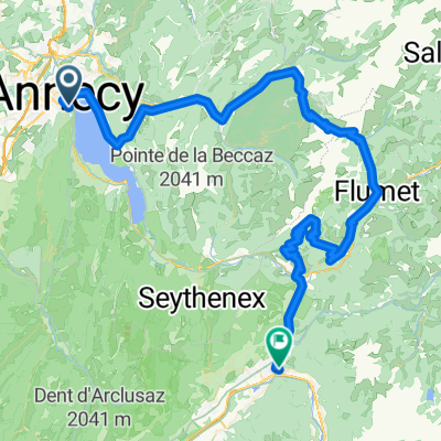
- 52.5 km
- Distance
- 788 m
- Ascent
- 789 m
- Descent
- ---
- Avg. speed
- ---
- Max. altitude
Route photos

Route quality
Waytypes & surfaces along the route
Waytypes
Cycleway
23.1 km
(44 %)
Road
17.3 km
(33 %)
Surfaces
Paved
51.4 km
(98 %)
Asphalt
51.4 km
(98 %)
Undefined
1 km
(2 %)
Continue with Bikemap
Use, edit, or download this cycling route
You would like to ride 1re étape : Annecy-Forclaz-Annecy par Perroix or customize it for your own trip? Here is what you can do with this Bikemap route:
Free features
- Save this route as favorite or in collections
- Copy & plan your own version of this route
- Sync your route with Garmin or Wahoo
Premium features
Free trial for 3 days, or one-time payment. More about Bikemap Premium.
- Navigate this route on iOS & Android
- Export a GPX / KML file of this route
- Create your custom printout (try it for free)
- Download this route for offline navigation
Discover more Premium features.
Get Bikemap PremiumFrom our community
Other popular routes starting in Annecy
 Col du Colombiere
- Distance
- 122.8 km
- Ascent
- 1,982 m
- Descent
- 1,982 m
- Location
- Annecy, Auvergne-Rhône-Alpes, France
 Annecy Loop 130km / 2800hm
- Distance
- 129.8 km
- Ascent
- 2,456 m
- Descent
- 2,455 m
- Location
- Annecy, Auvergne-Rhône-Alpes, France
 Rhone-Alpes: Etappe 1
- Distance
- 100.2 km
- Ascent
- 1,888 m
- Descent
- 1,997 m
- Location
- Annecy, Auvergne-Rhône-Alpes, France
 2023_Frankring_Lac d'Annecy Cycle Path
- Distance
- 38.2 km
- Ascent
- 321 m
- Descent
- 321 m
- Location
- Annecy, Auvergne-Rhône-Alpes, France
 02 Annecy-Moûtiers
- Distance
- 70.8 km
- Ascent
- 294 m
- Descent
- 268 m
- Location
- Annecy, Auvergne-Rhône-Alpes, France
 J1 V2 – Lac et Semnoz
- Distance
- 55 km
- Ascent
- 1,488 m
- Descent
- 1,488 m
- Location
- Annecy, Auvergne-Rhône-Alpes, France
 FORCLAZ MONTMIN VERSANT SUD 31MAI 2014
- Distance
- 54.5 km
- Ascent
- 757 m
- Descent
- 759 m
- Location
- Annecy, Auvergne-Rhône-Alpes, France
 Annecy lac et Semnoz
- Distance
- 73 km
- Ascent
- 1,463 m
- Descent
- 1,462 m
- Location
- Annecy, Auvergne-Rhône-Alpes, France
Open it in the app