

Espréou/Ceuse
A cycling route starting in La Roche-des-Arnauds, Provence-Alpes-Côte d'Azur Region, France.
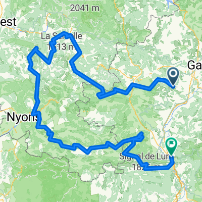
Overview
About this route
- -:--
- Duration
- 61.9 km
- Distance
- 745 m
- Ascent
- 1,007 m
- Descent
- ---
- Avg. speed
- ---
- Max. altitude
Route quality
Waytypes & surfaces along the route
Waytypes
Road
38.8 km
(63 %)
Quiet road
17.9 km
(29 %)
Surfaces
Paved
7.5 km
(12 %)
Asphalt
7.5 km
(12 %)
Undefined
54.4 km
(88 %)
Continue with Bikemap
Use, edit, or download this cycling route
You would like to ride Espréou/Ceuse or customize it for your own trip? Here is what you can do with this Bikemap route:
Free features
- Save this route as favorite or in collections
- Copy & plan your own version of this route
- Sync your route with Garmin or Wahoo
Premium features
Free trial for 3 days, or one-time payment. More about Bikemap Premium.
- Navigate this route on iOS & Android
- Export a GPX / KML file of this route
- Create your custom printout (try it for free)
- Download this route for offline navigation
Discover more Premium features.
Get Bikemap PremiumFrom our community
Other popular routes starting in La Roche-des-Arnauds
 2015 Montmaur-Barcelonnette
- Distance
- 86.1 km
- Ascent
- 837 m
- Descent
- 651 m
- Location
- La Roche-des-Arnauds, Provence-Alpes-Côte d'Azur Region, France
 Pelleautier - Prats Hauts
- Distance
- 100.4 km
- Ascent
- 2,553 m
- Descent
- 1,812 m
- Location
- La Roche-des-Arnauds, Provence-Alpes-Côte d'Azur Region, France
 Traversée la Rama par l’Aiglière et Rocher Rond
- Distance
- 12.4 km
- Ascent
- 1,284 m
- Descent
- 1,284 m
- Location
- La Roche-des-Arnauds, Provence-Alpes-Côte d'Azur Region, France
 Le desert - Le Desert met campings (deel 2) - Le Desert met campings (deel 1)
- Distance
- 343.9 km
- Ascent
- 10,632 m
- Descent
- 11,411 m
- Location
- La Roche-des-Arnauds, Provence-Alpes-Côte d'Azur Region, France
 montagne
- Distance
- 237.1 km
- Ascent
- 13,458 m
- Descent
- 14,782 m
- Location
- La Roche-des-Arnauds, Provence-Alpes-Côte d'Azur Region, France
 13 francia
- Distance
- 111 km
- Ascent
- 2,299 m
- Descent
- 2,524 m
- Location
- La Roche-des-Arnauds, Provence-Alpes-Côte d'Azur Region, France
 Ça déconfiture
- Distance
- 135.7 km
- Ascent
- 1,009 m
- Descent
- 1,911 m
- Location
- La Roche-des-Arnauds, Provence-Alpes-Côte d'Azur Region, France
 Senas par Sault
- Distance
- 188.6 km
- Ascent
- 1,283 m
- Descent
- 2,221 m
- Location
- La Roche-des-Arnauds, Provence-Alpes-Côte d'Azur Region, France
Open it in the app