

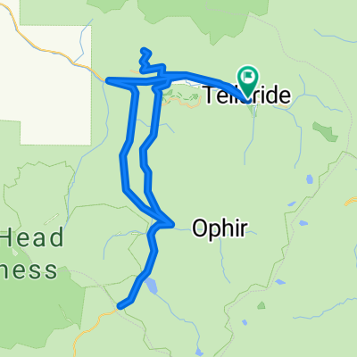
telluride - airport - lizard head - ilium loop
A cycling route starting in Telluride, Colorado, United States.
Overview
About this route
- 3 h 55 min
- Duration
- 67.5 km
- Distance
- 1,515 m
- Ascent
- 1,516 m
- Descent
- 17.3 km/h
- Avg. speed
- ---
- Max. altitude

Route quality
Waytypes & surfaces along the route
Waytypes
Quiet road
17.6 km
(26 %)
Cycleway
10.1 km
(15 %)
Surfaces
Paved
57.4 km
(85 %)
Unpaved
10.8 km
(16 %)
Asphalt
31.7 km
(47 %)
Paved (undefined)
25.7 km
(38 %)
Continue with Bikemap
Use, edit, or download this cycling route
You would like to ride telluride - airport - lizard head - ilium loop or customize it for your own trip? Here is what you can do with this Bikemap route:
Free features
- Save this route as favorite or in collections
- Copy & plan your own version of this route
- Sync your route with Garmin or Wahoo
Premium features
Free trial for 3 days, or one-time payment. More about Bikemap Premium.
- Navigate this route on iOS & Android
- Export a GPX / KML file of this route
- Create your custom printout (try it for free)
- Download this route for offline navigation
Discover more Premium features.
Get Bikemap PremiumFrom our community
Other popular routes starting in Telluride
 2016 Bike Tour Day 2: Telluride to Rico
- Distance
- 44.7 km
- Ascent
- 759 m
- Descent
- 756 m
- Location
- Telluride, Colorado, United States
 28alt
28alt- Distance
- 18.9 km
- Ascent
- 573 m
- Descent
- 1,271 m
- Location
- Telluride, Colorado, United States
 D1 Start to Last Dollar Hut
- Distance
- 20.6 km
- Ascent
- 855 m
- Descent
- 254 m
- Location
- Telluride, Colorado, United States
 333 S Davis St, Telluride to 301–699 N Trout Lake Rd, Ophir
- Distance
- 22.8 km
- Ascent
- 701 m
- Descent
- 408 m
- Location
- Telluride, Colorado, United States
 Telluide-Mountain Village-Ames-Illium-Last Dollar
- Distance
- 66.1 km
- Ascent
- 1,085 m
- Descent
- 1,059 m
- Location
- Telluride, Colorado, United States
 Telluride-Mountain Village
- Distance
- 12.2 km
- Ascent
- 324 m
- Descent
- 97 m
- Location
- Telluride, Colorado, United States
 37.938° N -107.818° W to 37.965° N -107.906° W
- Distance
- 11.2 km
- Ascent
- 277 m
- Descent
- 214 m
- Location
- Telluride, Colorado, United States
 telluride - airport - lizard head - ilium loop
- Distance
- 67.5 km
- Ascent
- 1,515 m
- Descent
- 1,516 m
- Location
- Telluride, Colorado, United States
Open it in the app