

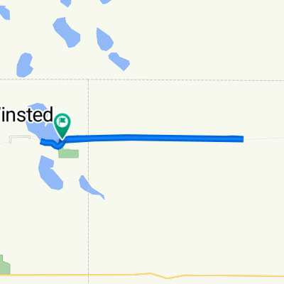
4th Street North 560, Winsted to 4th Street North 560, Winsted
A cycling route starting in Winsted, Minnesota, United States.
Overview
About this route
- 1 h 30 min
- Duration
- 32 km
- Distance
- 88 m
- Ascent
- 92 m
- Descent
- 21.3 km/h
- Avg. speed
- ---
- Max. altitude

Route photos

Route quality
Waytypes & surfaces along the route
Waytypes
Cycleway
25.5 km
(80 %)
Quiet road
3.5 km
(11 %)
Surfaces
Paved
25.5 km
(80 %)
Asphalt
25.5 km
(80 %)
Undefined
6.5 km
(20 %)
Continue with Bikemap
Use, edit, or download this cycling route
You would like to ride 4th Street North 560, Winsted to 4th Street North 560, Winsted or customize it for your own trip? Here is what you can do with this Bikemap route:
Free features
- Save this route as favorite or in collections
- Copy & plan your own version of this route
- Sync your route with Garmin or Wahoo
Premium features
Free trial for 3 days, or one-time payment. More about Bikemap Premium.
- Navigate this route on iOS & Android
- Export a GPX / KML file of this route
- Create your custom printout (try it for free)
- Download this route for offline navigation
Discover more Premium features.
Get Bikemap PremiumFrom our community
Other popular routes starting in Winsted
 Zion Avenue 23438, Winsted to Zion Avenue 23438, Winsted
- Distance
- 88.6 km
- Ascent
- 383 m
- Descent
- 360 m
- Location
- Winsted, Minnesota, United States
 Scooter Route -- Winsted To Eden Prairie
- Distance
- 69.1 km
- Ascent
- 172 m
- Descent
- 225 m
- Location
- Winsted, Minnesota, United States
 534–560 Baker Ave W, Winsted to 555 Baker Ave W, Winsted
- Distance
- 29.4 km
- Ascent
- 67 m
- Descent
- 66 m
- Location
- Winsted, Minnesota, United States
 4th Street North 560, Winsted to 4th Street North 560, Winsted
- Distance
- 32 km
- Ascent
- 88 m
- Descent
- 92 m
- Location
- Winsted, Minnesota, United States
 Zion Avenue 23438, Winsted to Zion Avenue 23438, Winsted
- Distance
- 9.8 km
- Ascent
- 46 m
- Descent
- 26 m
- Location
- Winsted, Minnesota, United States
 4th Street North 560, Winsted to 4th Street North 560, Winsted
- Distance
- 17.6 km
- Ascent
- 44 m
- Descent
- 48 m
- Location
- Winsted, Minnesota, United States
 Zion Avenue 23438, Winsted to Zion Avenue 23438, Winsted
- Distance
- 90.9 km
- Ascent
- 100 m
- Descent
- 80 m
- Location
- Winsted, Minnesota, United States
 Saint Peter Scooter Trip
- Distance
- 160.5 km
- Ascent
- 170 m
- Descent
- 195 m
- Location
- Winsted, Minnesota, United States
Open it in the app