

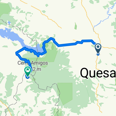
San Lorenzo
A cycling route starting in Quesada, Alajuela Province, Costa Rica.
Overview
About this route
- 2 h 20 min
- Duration
- 22.6 km
- Distance
- 102 m
- Ascent
- 91 m
- Descent
- 9.7 km/h
- Avg. speed
- ---
- Max. altitude

Continue with Bikemap
Use, edit, or download this cycling route
You would like to ride San Lorenzo or customize it for your own trip? Here is what you can do with this Bikemap route:
Free features
- Save this route as favorite or in collections
- Copy & plan your own version of this route
- Sync your route with Garmin or Wahoo
Premium features
Free trial for 3 days, or one-time payment. More about Bikemap Premium.
- Navigate this route on iOS & Android
- Export a GPX / KML file of this route
- Create your custom printout (try it for free)
- Download this route for offline navigation
Discover more Premium features.
Get Bikemap PremiumFrom our community
Other popular routes starting in Quesada
 Camino Danga Elena
- Distance
- 19 km
- Ascent
- 323 m
- Descent
- 328 m
- Location
- Quesada, Alajuela Province, Costa Rica
 Quesada - Monteverde
- Distance
- 100.6 km
- Ascent
- 1,713 m
- Descent
- 411 m
- Location
- Quesada, Alajuela Province, Costa Rica
 San Lorenzo
- Distance
- 22.6 km
- Ascent
- 102 m
- Descent
- 91 m
- Location
- Quesada, Alajuela Province, Costa Rica
 flore-starita
- Distance
- 9.7 km
- Ascent
- 159 m
- Descent
- 209 m
- Location
- Quesada, Alajuela Province, Costa Rica
 ciudat quesada - arenal
- Distance
- 94.9 km
- Ascent
- 680 m
- Descent
- 752 m
- Location
- Quesada, Alajuela Province, Costa Rica
 Paseo lento en San Carlos
- Distance
- 20.9 km
- Ascent
- 260 m
- Descent
- 261 m
- Location
- Quesada, Alajuela Province, Costa Rica
 Santa Clara Boca de Arenal
- Distance
- 31 km
- Ascent
- 137 m
- Descent
- 240 m
- Location
- Quesada, Alajuela Province, Costa Rica
 Ruta relajada en San Carlos
- Distance
- 3.7 km
- Ascent
- 49 m
- Descent
- 50 m
- Location
- Quesada, Alajuela Province, Costa Rica
Open it in the app