

Clifton Link
A cycling route starting in Bristol, England, United Kingdom.
Overview
About this route
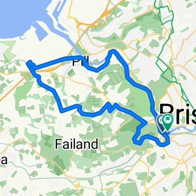
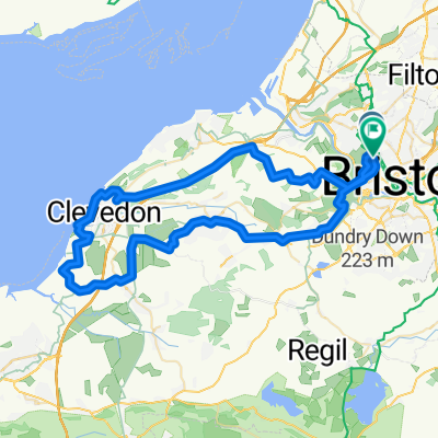
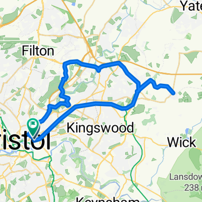
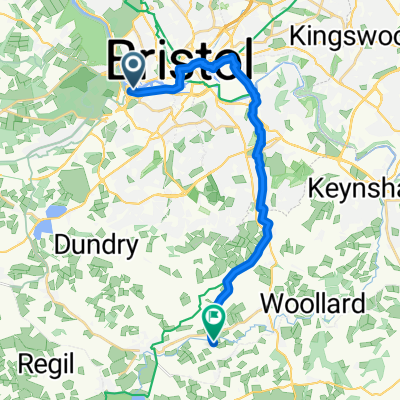
Connects Clifton to Avon Cycleway at Felton going out through Ashton Court to Festival Way (but avoiding the very confusing section through housing estates). Then via lanes with a couple modest hills to Felton. Can be used in conjunction with the Clevedon and Pensford/Saltford loops.
- -:--
- Duration
- 13.4 km
- Distance
- 199 m
- Ascent
- 124 m
- Descent
- ---
- Avg. speed
- ---
- Max. altitude
Route quality
Waytypes & surfaces along the route
Waytypes
Quiet road
5.2 km
(39 %)
Cycleway
2.4 km
(18 %)
Surfaces
Paved
8.4 km
(63 %)
Unpaved
0.1 km
(1 %)
Asphalt
8.4 km
(63 %)
Gravel
0.1 km
(1 %)
Undefined
4.8 km
(36 %)
Route highlights
Points of interest along the route
Point of interest after 10.3 km
More a warning that the routes crosses the sometimes busy A38 here.
Continue with Bikemap
Use, edit, or download this cycling route
You would like to ride Clifton Link or customize it for your own trip? Here is what you can do with this Bikemap route:
Free features
- Save this route as favorite or in collections
- Copy & plan your own version of this route
- Sync your route with Garmin or Wahoo
Premium features
Free trial for 3 days, or one-time payment. More about Bikemap Premium.
- Navigate this route on iOS & Android
- Export a GPX / KML file of this route
- Create your custom printout (try it for free)
- Download this route for offline navigation
Discover more Premium features.
Get Bikemap PremiumFrom our community
Other popular routes starting in Bristol
 Bristol to Gloucester
- Distance
- 52.6 km
- Ascent
- 209 m
- Descent
- 278 m
- Location
- Bristol, England, United Kingdom
 Out & Back to the Severn
- Distance
- 58.3 km
- Ascent
- 298 m
- Descent
- 301 m
- Location
- Bristol, England, United Kingdom
 Abbots Pool Sociable bimble (modified)
- Distance
- 26.8 km
- Ascent
- 349 m
- Descent
- 352 m
- Location
- Bristol, England, United Kingdom
 M5 Pastoral
- Distance
- 61.8 km
- Ascent
- 586 m
- Descent
- 600 m
- Location
- Bristol, England, United Kingdom
 Cycle exp
- Distance
- 49.8 km
- Ascent
- 211 m
- Descent
- 234 m
- Location
- Bristol, England, United Kingdom
 Cakesmith (BS2 0JZ) - Pucklechurch
- Distance
- 32.2 km
- Ascent
- 233 m
- Descent
- 229 m
- Location
- Bristol, England, United Kingdom
 Steady ride in Bristol
- Distance
- 13.2 km
- Ascent
- 160 m
- Descent
- 161 m
- Location
- Bristol, England, United Kingdom
 To Stanton Drew, 11m, Druids Arms
- Distance
- 17.6 km
- Ascent
- 155 m
- Descent
- 117 m
- Location
- Bristol, England, United Kingdom
Open it in the app