Soneja-Navajas-Matet-Alto de Villamalur-Algímia d'Almonacid
A cycling route starting in Soneja, Valencia, Spain.
Overview
About this route
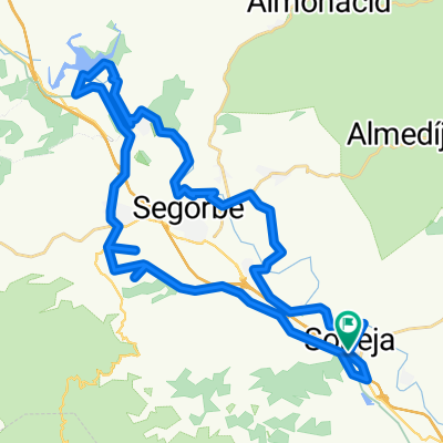
Soneja-Segorbe-Navajas-Gaibiel-Matet-Alto de Villamalur-Matet-Algímia d'Almonacid-Vall d'Almonacid-Peñalba-Geldo-Soneja.
- -:--
- Duration
- 57.1 km
- Distance
- 688 m
- Ascent
- 688 m
- Descent
- ---
- Avg. speed
- ---
- Avg. speed
Route quality
Waytypes & surfaces along the route
Waytypes
Road
28.6 km
(50 %)
Quiet road
13.5 km
(24 %)
Surfaces
Paved
13.4 km
(23 %)
Unpaved
2.6 km
(4 %)
Asphalt
13.3 km
(23 %)
Gravel
2 km
(3 %)
Continue with Bikemap
Use, edit, or download this cycling route
You would like to ride Soneja-Navajas-Matet-Alto de Villamalur-Algímia d'Almonacid or customize it for your own trip? Here is what you can do with this Bikemap route:
Free features
- Save this route as favorite or in collections
- Copy & plan your own version of this route
- Sync your route with Garmin or Wahoo
Premium features
Free trial for 3 days, or one-time payment. More about Bikemap Premium.
- Navigate this route on iOS & Android
- Export a GPX / KML file of this route
- Create your custom printout (try it for free)
- Download this route for offline navigation
Discover more Premium features.
Get Bikemap PremiumFrom our community
Other popular routes starting in Soneja
- 3 dias
- Distance
- 232.4 km
- Ascent
- 2,205 m
- Descent
- 2,207 m
- Location
- Soneja, Valencia, Spain
- Soneja-Almedijar-Collado de la Ibola-Villamalur-Collado Jinquer-Matet-Segorbe-Soneja
- Distance
- 78.2 km
- Ascent
- 1,294 m
- Descent
- 1,280 m
- Location
- Soneja, Valencia, Spain
- espadan desde soneja
- Distance
- 103.9 km
- Ascent
- 1,873 m
- Descent
- 1,870 m
- Location
- Soneja, Valencia, Spain
- Soneja-Chovar-Eslida-Ain-Collado de La Ibola-Almedijar-Soneja
- Distance
- 49.8 km
- Ascent
- 943 m
- Descent
- 939 m
- Location
- Soneja, Valencia, Spain
- 104 kms soneja-eslida-ain- vilamallur- nevera-almedijar-soneja
- Distance
- 104.8 km
- Ascent
- 1,767 m
- Descent
- 1,757 m
- Location
- Soneja, Valencia, Spain
- Ruta 20: Soneja - Algimia - Serra
- Distance
- 43.2 km
- Ascent
- 900 m
- Descent
- 833 m
- Location
- Soneja, Valencia, Spain
- Soneja - Altura - Regajo - Navajas - Salto de La Novia
- Distance
- 42.1 km
- Ascent
- 392 m
- Descent
- 391 m
- Location
- Soneja, Valencia, Spain
- Soneja-Algímia d'Almonacid
- Distance
- 51.5 km
- Ascent
- 833 m
- Descent
- 833 m
- Location
- Soneja, Valencia, Spain
Open it in the app