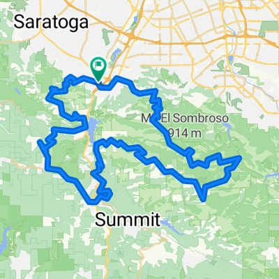
Soda Springs Climb
A cycling route starting in Los Gatos, California, United States of America.
Overview
About this route
- -:--
- Duration
- 29.5 km
- Distance
- 828 m
- Ascent
- 826 m
- Descent
- ---
- Avg. speed
- ---
- Avg. speed
Continue with Bikemap
Use, edit, or download this cycling route
You would like to ride Soda Springs Climb or customize it for your own trip? Here is what you can do with this Bikemap route:
Free features
- Save this route as favorite or in collections
- Copy & plan your own version of this route
- Sync your route with Garmin or Wahoo
Premium features
Free trial for 3 days, or one-time payment. More about Bikemap Premium.
- Navigate this route on iOS & Android
- Export a GPX / KML file of this route
- Create your custom printout (try it for free)
- Download this route for offline navigation
Discover more Premium features.
Get Bikemap PremiumFrom our community
Other popular routes starting in Los Gatos
- los gatos 1
- Distance
- 15.7 km
- Ascent
- 384 m
- Descent
- 277 m
- Location
- Los Gatos, California, United States of America
- lexington reservoir
- Distance
- 12.4 km
- Ascent
- 253 m
- Descent
- 253 m
- Location
- Los Gatos, California, United States of America
- Los Gatos
- Distance
- 8.9 km
- Ascent
- 930 m
- Descent
- 930 m
- Location
- Los Gatos, California, United States of America
- Limekiln train
- Distance
- 17.9 km
- Ascent
- 815 m
- Descent
- 812 m
- Location
- Los Gatos, California, United States of America
- Shannon Kennedy
- Distance
- 13.4 km
- Ascent
- 277 m
- Descent
- 267 m
- Location
- Los Gatos, California, United States of America
- Los Gatos Hills
- Distance
- 82.8 km
- Ascent
- 2,484 m
- Descent
- 2,484 m
- Location
- Los Gatos, California, United States of America
- Limekiln / Preist Rock Loop
- Distance
- 19 km
- Ascent
- 785 m
- Descent
- 786 m
- Location
- Los Gatos, California, United States of America
- Los Gatos
- Distance
- 38.4 km
- Ascent
- 510 m
- Descent
- 509 m
- Location
- Los Gatos, California, United States of America
Open it in the app