

Langenhagen und Isernhagen Rundkurs
A cycling route starting in Langenhagen, Lower Saxony, Germany.
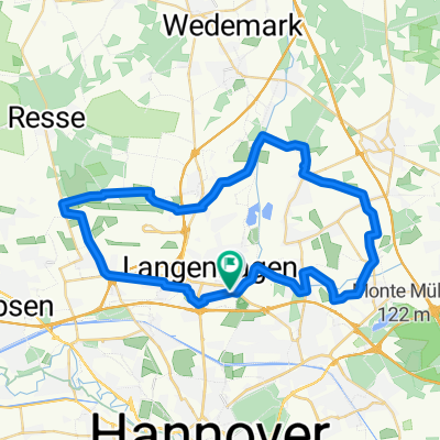
Overview
About this route
often on quiet, low-traffic roads around Isernhagen and Hannover Airport...
- -:--
- Duration
- 41.7 km
- Distance
- 81 m
- Ascent
- 84 m
- Descent
- ---
- Avg. speed
- 78 m
- Max. altitude
Route quality
Waytypes & surfaces along the route
Waytypes
Track
16.3 km
(39 %)
Quiet road
14.6 km
(35 %)
Surfaces
Paved
31.7 km
(76 %)
Unpaved
9.6 km
(23 %)
Asphalt
28.4 km
(68 %)
Gravel
6.3 km
(15 %)
Continue with Bikemap
Use, edit, or download this cycling route
You would like to ride Langenhagen und Isernhagen Rundkurs or customize it for your own trip? Here is what you can do with this Bikemap route:
Free features
- Save this route as favorite or in collections
- Copy & plan your own version of this route
- Sync your route with Garmin or Wahoo
Premium features
Free trial for 3 days, or one-time payment. More about Bikemap Premium.
- Navigate this route on iOS & Android
- Export a GPX / KML file of this route
- Create your custom printout (try it for free)
- Download this route for offline navigation
Discover more Premium features.
Get Bikemap PremiumFrom our community
Other popular routes starting in Langenhagen
 Isernhagen Rundkurs
- Distance
- 27.8 km
- Ascent
- 47 m
- Descent
- 54 m
- Location
- Langenhagen, Lower Saxony, Germany
 Flughafen - Döhren
- Distance
- 18.4 km
- Ascent
- 23 m
- Descent
- 22 m
- Location
- Langenhagen, Lower Saxony, Germany
 An der Neuen Bult, Langenhagen nach Hoppegartenring 140–148, Langenhagen
- Distance
- 24.2 km
- Ascent
- 53 m
- Descent
- 52 m
- Location
- Langenhagen, Lower Saxony, Germany
 Langenhagen und Isernhagen Rundkurs
- Distance
- 41.7 km
- Ascent
- 81 m
- Descent
- 84 m
- Location
- Langenhagen, Lower Saxony, Germany
 22.04. 45 km
- Distance
- 15.2 km
- Ascent
- 48 m
- Descent
- 8 m
- Location
- Langenhagen, Lower Saxony, Germany
 Tour 1
- Distance
- 47.1 km
- Ascent
- 115 m
- Descent
- 116 m
- Location
- Langenhagen, Lower Saxony, Germany
 Flughafen_Kanal_Zurueck
- Distance
- 23.4 km
- Ascent
- 36 m
- Descent
- 34 m
- Location
- Langenhagen, Lower Saxony, Germany
 20160925_Moor_geht_nicht
- Distance
- 39.9 km
- Ascent
- 134 m
- Descent
- 137 m
- Location
- Langenhagen, Lower Saxony, Germany
Open it in the app