

teddy
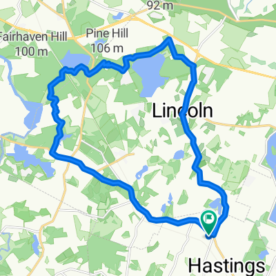
A cycling route starting in Weston, Massachusetts, United States.
Overview
About this route
- 1 h 38 min
- Duration
- 28.8 km
- Distance
- 222 m
- Ascent
- 219 m
- Descent
- 17.6 km/h
- Avg. speed
- ---
- Max. altitude

Route quality
Waytypes & surfaces along the route
Waytypes
Road
16.7 km
(58 %)
Cycleway
5.5 km
(19 %)
Surfaces
Paved
22.4 km
(78 %)
Asphalt
14.7 km
(51 %)
Paved (undefined)
7.8 km
(27 %)
Undefined
6.3 km
(22 %)
Continue with Bikemap
Use, edit, or download this cycling route
You would like to ride teddy or customize it for your own trip? Here is what you can do with this Bikemap route:
Free features
- Save this route as favorite or in collections
- Copy & plan your own version of this route
- Sync your route with Garmin or Wahoo
Premium features
Free trial for 3 days, or one-time payment. More about Bikemap Premium.
- Navigate this route on iOS & Android
- Export a GPX / KML file of this route
- Create your custom printout (try it for free)
- Download this route for offline navigation
Discover more Premium features.
Get Bikemap PremiumFrom our community
Other popular routes starting in Weston
 Relaxed route in Weston2
- Distance
- 19 km
- Ascent
- 402 m
- Descent
- 402 m
- Location
- Weston, Massachusetts, United States
 Weston-Wayland Light Workout
- Distance
- 23 km
- Ascent
- 120 m
- Descent
- 121 m
- Location
- Weston, Massachusetts, United States
 5 Raynor Rd, Weston to 4 Raynor Rd, Weston
- Distance
- 20.4 km
- Ascent
- 389 m
- Descent
- 401 m
- Location
- Weston, Massachusetts, United States
 Weston short track
- Distance
- 19.7 km
- Ascent
- 434 m
- Descent
- 425 m
- Location
- Weston, Massachusetts, United States
 Weston-Wayland abbrev
- Distance
- 14.8 km
- Ascent
- 98 m
- Descent
- 99 m
- Location
- Weston, Massachusetts, United States
 teddy
teddy- Distance
- 28.8 km
- Ascent
- 222 m
- Descent
- 219 m
- Location
- Weston, Massachusetts, United States
 Walden Pond Loop
- Distance
- 81.4 km
- Ascent
- 206 m
- Descent
- 207 m
- Location
- Weston, Massachusetts, United States
 Waltham To Hudson via East Coast Greenway
- Distance
- 76.7 km
- Ascent
- 241 m
- Descent
- 242 m
- Location
- Weston, Massachusetts, United States
Open it in the app