Rund um Eisighofen
- 30.5 km
- 547 m
- 547 m
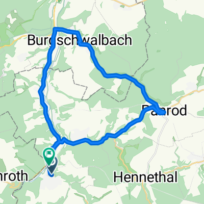
- Eisighofen, Rhineland-Palatinate, Germany
A cycling route starting in Eisighofen, Rhineland-Palatinate, Germany.
Overview
Only suitable for mountain bikes. Scenic trail with nice resting spots. Best to ride clockwise! Satellite image shows the route accurately outside urban areas.
created this 18 years ago
Route quality
Track
10.7 km
(77 %)
Quiet road
2.4 km
(17 %)
Undefined
0.8 km
(6 %)
Paved
3.5 km
(25 %)
Unpaved
8.4 km
(60 %)
Gravel
4 km
(29 %)
Asphalt
2.6 km
(19 %)
Route highlights
Anfang und Ende im Anschluss an der Fahrradweg zwischen Michelbach und Diez.
Schöner Blick und Pausenplatz
Jahres - und wetterbedingt kann dieser Feldweg sehr uneben sein.
Vorsicht - kurzes Stück über die Landstrasse.
Höhepunkt der Strecke. Panoramablick und Rastbank.
Continue with Bikemap
You would like to ride Aus Michelbach - rund um Holzhausen. or customize it for your own trip? Here is what you can do with this Bikemap route:
Free trial for 3 days, or one-time payment. More about Bikemap Premium.
Discover more Premium features.
Get Bikemap PremiumFrom our community
Open it in the app