
Grandes Alpes_Kudrna_Etapa7
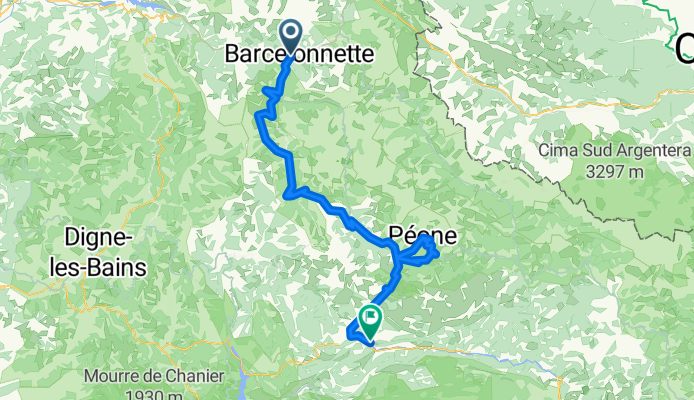
A cycling route starting in Barcelonnette, Provence-Alpes-Côte d'Azur Region, France.
Overview
About this route
The more information you write here, the more useful it will be for other users.* Route course.* What is special about this route?* Why recommend this route?* What did you like most about it here?* Etc.
- -:--
- Duration
- 133.2 km
- Distance
- 2,787 m
- Ascent
- 3,422 m
- Descent
- ---
- Avg. speed
- ---
- Max. altitude
Route highlights
Points of interest along the route
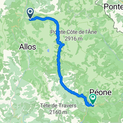
Point of interest after 18.2 km
Col d' Allos (2247m)
Point of interest after 51.9 km
Col des Champs (2045m)
Point of interest after 96.4 km
Valberg (1682m)
Continue with Bikemap
Use, edit, or download this cycling route
You would like to ride Grandes Alpes_Kudrna_Etapa7 or customize it for your own trip? Here is what you can do with this Bikemap route:
Free features
- Save this route as favorite or in collections
- Copy & plan your own version of this route
- Split it into stages to create a multi-day tour
- Sync your route with Garmin or Wahoo
Premium features
Free trial for 3 days, or one-time payment. More about Bikemap Premium.
- Navigate this route on iOS & Android
- Export a GPX / KML file of this route
- Create your custom printout (try it for free)
- Download this route for offline navigation
Discover more Premium features.
Get Bikemap PremiumFrom our community
Other popular routes starting in Barcelonnette
 Allauch 8. Etappe
- Distance
- 92.5 km
- Ascent
- 1,242 m
- Descent
- 1,623 m
- Location
- Barcelonnette, Provence-Alpes-Côte d'Azur Region, France
 3 col körtúra
- Distance
- 125.2 km
- Ascent
- 3,188 m
- Descent
- 3,188 m
- Location
- Barcelonnette, Provence-Alpes-Côte d'Azur Region, France
 Barcelonette Bonette
- Distance
- 183.5 km
- Ascent
- 4,521 m
- Descent
- 4,559 m
- Location
- Barcelonnette, Provence-Alpes-Côte d'Azur Region, France
 Barcelonnette (Uvernet-Fours) - Bayasse
- Distance
- 20.7 km
- Ascent
- 1,049 m
- Descent
- 403 m
- Location
- Barcelonnette, Provence-Alpes-Côte d'Azur Region, France
 Barcelonnette - Puget-Théniers
- Distance
- 54.3 km
- Ascent
- 1,144 m
- Descent
- 1,547 m
- Location
- Barcelonnette, Provence-Alpes-Côte d'Azur Region, France
 12 francia
- Distance
- 105.4 km
- Ascent
- 939 m
- Descent
- 1,194 m
- Location
- Barcelonnette, Provence-Alpes-Côte d'Azur Region, France
 Col de la Cayolle - Col des Champs - Col d'Allos
- Distance
- 121.2 km
- Ascent
- 3,137 m
- Descent
- 3,141 m
- Location
- Barcelonnette, Provence-Alpes-Côte d'Azur Region, France
 Tord de France 2008 - Tag 3 Col De La Bonette
- Distance
- 66.5 km
- Ascent
- 1,558 m
- Descent
- 1,558 m
- Location
- Barcelonnette, Provence-Alpes-Côte d'Azur Region, France
Open it in the app