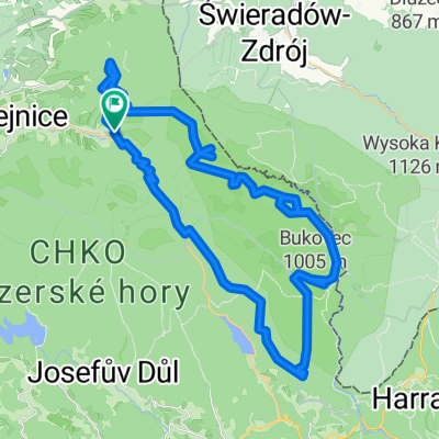
CZ-Laznie Libverda-Marianskohorskie boudy-44 km
A cycling route starting in Hejnice, Liberecký kraj, Czechia.
Overview
About this route
CZ-Laznie Libverda-Marianskohorskie boudy-44 km
- -:--
- Duration
- 43.5 km
- Distance
- 1,092 m
- Ascent
- 1,094 m
- Descent
- ---
- Avg. speed
- ---
- Avg. speed
Continue with Bikemap
Use, edit, or download this cycling route
You would like to ride CZ-Laznie Libverda-Marianskohorskie boudy-44 km or customize it for your own trip? Here is what you can do with this Bikemap route:
Free features
- Save this route as favorite or in collections
- Copy & plan your own version of this route
- Sync your route with Garmin or Wahoo
Premium features
Free trial for 3 days, or one-time payment. More about Bikemap Premium.
- Navigate this route on iOS & Android
- Export a GPX / KML file of this route
- Create your custom printout (try it for free)
- Download this route for offline navigation
Discover more Premium features.
Get Bikemap PremiumFrom our community
Other popular routes starting in Hejnice
- 07 - Libverda 2015 - LOP
- Distance
- 91.8 km
- Ascent
- 1,597 m
- Descent
- 1,608 m
- Location
- Hejnice, Liberecký kraj, Czechia
- 2020-06-30 Isergebirge
- Distance
- 74.7 km
- Ascent
- 1,551 m
- Descent
- 1,550 m
- Location
- Hejnice, Liberecký kraj, Czechia
- Singletrack pod Smrkem
- Distance
- 18.6 km
- Ascent
- 398 m
- Descent
- 404 m
- Location
- Hejnice, Liberecký kraj, Czechia
- CZ-Laznie Libverda-Marianskohorskie boudy-44 km
- Distance
- 43.5 km
- Ascent
- 1,092 m
- Descent
- 1,094 m
- Location
- Hejnice, Liberecký kraj, Czechia
- Přes Smrk na Pytlácké kameny a Paličník
- Distance
- 54.1 km
- Ascent
- 1,234 m
- Descent
- 1,234 m
- Location
- Hejnice, Liberecký kraj, Czechia
- 03 - Libverda 2015 - LOP
- Distance
- 33.2 km
- Ascent
- 300 m
- Descent
- 302 m
- Location
- Hejnice, Liberecký kraj, Czechia
- Bílý Potok - Jizerka
- Distance
- 19.4 km
- Ascent
- 611 m
- Descent
- 217 m
- Location
- Hejnice, Liberecký kraj, Czechia
- CZ-Laznie Libverda-Marianskohorskie boudy-38 km
- Distance
- 37.7 km
- Ascent
- 844 m
- Descent
- 846 m
- Location
- Hejnice, Liberecký kraj, Czechia
Open it in the app