

Jalan Raya Jompo, Kecamatan Kalimanah to Jalan Raya Muntang, Kecamatan Kemangkon
A cycling route starting in Purbalingga, Central Java, Indonesia.
Overview
About this route
- 2 h 24 min
- Duration
- 18.1 km
- Distance
- 113 m
- Ascent
- 126 m
- Descent
- 7.5 km/h
- Avg. speed
- ---
- Max. altitude

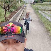
Route photos


Route quality
Waytypes & surfaces along the route
Waytypes
Quiet road
7.4 km
(41 %)
Road
0.4 km
(2 %)
Surfaces
Paved
4.5 km
(25 %)
Asphalt
4.5 km
(25 %)
Undefined
13.6 km
(75 %)
Continue with Bikemap
Use, edit, or download this cycling route
You would like to ride Jalan Raya Jompo, Kecamatan Kalimanah to Jalan Raya Muntang, Kecamatan Kemangkon or customize it for your own trip? Here is what you can do with this Bikemap route:
Free features
- Save this route as favorite or in collections
- Copy & plan your own version of this route
- Sync your route with Garmin or Wahoo
Premium features
Free trial for 3 days, or one-time payment. More about Bikemap Premium.
- Navigate this route on iOS & Android
- Export a GPX / KML file of this route
- Create your custom printout (try it for free)
- Download this route for offline navigation
Discover more Premium features.
Get Bikemap PremiumFrom our community
Other popular routes starting in Purbalingga
 Jalan Raya Klampok, Kecamatan Purworejo Klampok to Dusun I, Kecamatan Bukateja
- Distance
- 4.9 km
- Ascent
- 41 m
- Descent
- 59 m
- Location
- Purbalingga, Central Java, Indonesia
 Jalan Letkol Isdiman 99, Kecamatan Purbalingga to J957+CC6, Kecamatan Purbalingga
- Distance
- 22.7 km
- Ascent
- 182 m
- Descent
- 197 m
- Location
- Purbalingga, Central Java, Indonesia
 purbalingga city
- Distance
- 17.5 km
- Ascent
- 512 m
- Descent
- 529 m
- Location
- Purbalingga, Central Java, Indonesia
 Jalan Selateri No 5, Kecamatan Padamara to Jalan Selateri No 5, Kecamatan Padamara
- Distance
- 24.9 km
- Ascent
- 234 m
- Descent
- 239 m
- Location
- Purbalingga, Central Java, Indonesia
 Jalan Letnan Yusuf 2, Kecamatan Padamara to Jalan Letnan Yusuf 2, Kecamatan Padamara
- Distance
- 10.8 km
- Ascent
- 73 m
- Descent
- 68 m
- Location
- Purbalingga, Central Java, Indonesia
 Easy ride
- Distance
- 52.6 km
- Ascent
- 271 m
- Descent
- 296 m
- Location
- Purbalingga, Central Java, Indonesia
 Jalan Raya Jompo, Kecamatan Kalimanah to Jalan Raya Muntang, Kecamatan Kemangkon
- Distance
- 18.1 km
- Ascent
- 113 m
- Descent
- 126 m
- Location
- Purbalingga, Central Java, Indonesia
 Gowes Adek
- Distance
- 6.6 km
- Ascent
- 30 m
- Descent
- 56 m
- Location
- Purbalingga, Central Java, Indonesia
Open it in the app