
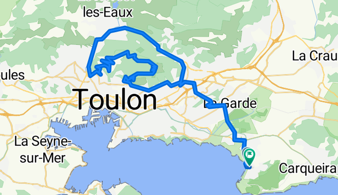
Toulon - Camargue 1992 Etappe 1
A cycling route starting in Le Pradet, Provence-Alpes-Côte d'Azur Region, France.
Overview
About this route
Mont Faron
- -:--
- Duration
- 44.7 km
- Distance
- 1,146 m
- Ascent
- 1,095 m
- Descent
- ---
- Avg. speed
- 544 m
- Max. altitude
Route quality
Waytypes & surfaces along the route
Waytypes
Busy road
16.4 km
(37 %)
Quiet road
12.6 km
(28 %)
Surfaces
Paved
24.2 km
(54 %)
Asphalt
24.2 km
(54 %)
Undefined
20.5 km
(46 %)
Continue with Bikemap
Use, edit, or download this cycling route
You would like to ride Toulon - Camargue 1992 Etappe 1 or customize it for your own trip? Here is what you can do with this Bikemap route:
Free features
- Save this route as favorite or in collections
- Copy & plan your own version of this route
- Sync your route with Garmin or Wahoo
Premium features
Free trial for 3 days, or one-time payment. More about Bikemap Premium.
- Navigate this route on iOS & Android
- Export a GPX / KML file of this route
- Create your custom printout (try it for free)
- Download this route for offline navigation
Discover more Premium features.
Get Bikemap PremiumFrom our community
Other popular routes starting in Le Pradet
 De Avenue Jean Moulin 715, Le Pradet à Boulevard de l'Europe 475, La Seyne-sur-Mer
- Distance
- 13.2 km
- Ascent
- 3 m
- Descent
- 0 m
- Location
- Le Pradet, Provence-Alpes-Côte d'Azur Region, France
 Route to Chemin de Cabro, 83320 Carqueiranne
- Distance
- 42 km
- Ascent
- 286 m
- Descent
- 316 m
- Location
- Le Pradet, Provence-Alpes-Côte d'Azur Region, France
 Day 53 | Le Pradet to Le Lavandou
- Distance
- 59.4 km
- Ascent
- 430 m
- Descent
- 473 m
- Location
- Le Pradet, Provence-Alpes-Côte d'Azur Region, France
 moin
moin- Distance
- 53.1 km
- Ascent
- 517 m
- Descent
- 515 m
- Location
- Le Pradet, Provence-Alpes-Côte d'Azur Region, France
 Carqueiranne
- Distance
- 49.1 km
- Ascent
- 312 m
- Descent
- 310 m
- Location
- Le Pradet, Provence-Alpes-Côte d'Azur Region, France
 80 Km Flat
- Distance
- 80.9 km
- Ascent
- 317 m
- Descent
- 317 m
- Location
- Le Pradet, Provence-Alpes-Côte d'Azur Region, France
 13e étape : Le Pradet - Sanary sur Mer - crono
- Distance
- 49.7 km
- Ascent
- 391 m
- Descent
- 422 m
- Location
- Le Pradet, Provence-Alpes-Côte d'Azur Region, France
 Finale to finale!
- Distance
- 411.5 km
- Ascent
- 4,027 m
- Descent
- 4,047 m
- Location
- Le Pradet, Provence-Alpes-Côte d'Azur Region, France
Open it in the app