

22-8-10 F.Vaqueros-PinosPuente-Búcor-Tiena-Moclín-Tózar-Colomera-Berbes (IBP: 102)
A cycling route starting in Fuente Vaqueros, Andalusia, Spain.
Overview
About this route
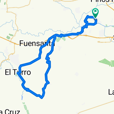
Today's route felt a bit long with so many climbs and so much asphalt, even though it doesn't have great difficulty (IBP: 102). It is practically half track (trail) and half asphalt, but very, very quiet and traffic-free. The points that may present more difficulty are the climb up to Tiena (tough at times due to the poor condition of the trail in some sections, but you can easily find a comfortable alternative on asphalt), the descent from Moclín to the bridge over the Velillos (for the same reason), and the very fast descent from the highest point of the route down to the road to Colomera, which has good gradients and you can reach significant speed, but you must be careful because you can suddenly encounter sharp bends where brakes might not be enough despite the asphalt or concrete ramp. These last two descents would undoubtedly be good challenges to do by reversing the route's direction... We'll have to try it. Oh, and a really tricky point: the rocky climb at the Roman bridge crossing. It's hard not to put a foot down because of the loose ground and the slope, so it's almost better to look for the asphalt alternative that starts from the bridge immediately before the Roman one. Otherwise, it's quite comfortable to ride, with some fountains here and there (although not in Colomera, where they were all dry). Moreover, the views are one of the biggest attractions of this route.
- -:--
- Duration
- 64.1 km
- Distance
- 1,004 m
- Ascent
- 1,004 m
- Descent
- ---
- Avg. speed
- ---
- Max. altitude

Continue with Bikemap
Use, edit, or download this cycling route
You would like to ride 22-8-10 F.Vaqueros-PinosPuente-Búcor-Tiena-Moclín-Tózar-Colomera-Berbes (IBP: 102) or customize it for your own trip? Here is what you can do with this Bikemap route:
Free features
- Save this route as favorite or in collections
- Copy & plan your own version of this route
- Sync your route with Garmin or Wahoo
Premium features
Free trial for 3 days, or one-time payment. More about Bikemap Premium.
- Navigate this route on iOS & Android
- Export a GPX / KML file of this route
- Create your custom printout (try it for free)
- Download this route for offline navigation
Discover more Premium features.
Get Bikemap PremiumFrom our community
Other popular routes starting in Fuente Vaqueros
 12-9-10 F.Vaqueros-Cijuela-Romilla la Nueva-Canal de Cacín-Chimeneas-Aguas Calientes-El Jau (IBP:40)
- Distance
- 44.3 km
- Ascent
- 333 m
- Descent
- 331 m
- Location
- Fuente Vaqueros, Andalusia, Spain
 31-8-10 F.Vaqueros-Láchar-Peñuelas-C.Tajarja-Chimeneas-S.Catalina-P.Periurbano-Jau (IBP:67)
- Distance
- 57.9 km
- Ascent
- 617 m
- Descent
- 619 m
- Location
- Fuente Vaqueros, Andalusia, Spain
 25-8-10 F.Vaqueros-Láchar-Daimuz Bajo-CC.Blancas-Daragoleja-Daimuz Alto-San Pascual-Ánzola (IBP:28)
- Distance
- 34.7 km
- Ascent
- 185 m
- Descent
- 185 m
- Location
- Fuente Vaqueros, Andalusia, Spain
 11-9-10 F.Vaqueros-El Jau-Parque Periurbano de Santa Fe (toboganes y vereda) (IBP: 48)
- Distance
- 37 km
- Ascent
- 405 m
- Descent
- 406 m
- Location
- Fuente Vaqueros, Andalusia, Spain
 26-6-10 F.Vaqueros-Casanueva-Coscojar-P.Zujaira-Obeilar-Lachar (IBP: 85)
- Distance
- 45.1 km
- Ascent
- 657 m
- Descent
- 657 m
- Location
- Fuente Vaqueros, Andalusia, Spain
 11-6-10 Ruta de los conejos (F.Vaqueros-Láchar-Daimuz-Brácana-La Loma) (IBP: 54)
- Distance
- 54.7 km
- Ascent
- 388 m
- Descent
- 388 m
- Location
- Fuente Vaqueros, Andalusia, Spain
 25-8-10 F.Vaqueros-Cijuela-Láchar-Castillo de Tajarja-Cjo. Bujeda-El Turro (IBP: 50)
- Distance
- 55.6 km
- Ascent
- 472 m
- Descent
- 472 m
- Location
- Fuente Vaqueros, Andalusia, Spain
 6-9-10 Llaneando por la Vega 2 (IBP: 15)
- Distance
- 21.2 km
- Ascent
- 43 m
- Descent
- 41 m
- Location
- Fuente Vaqueros, Andalusia, Spain
Open it in the app