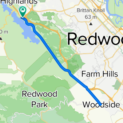
36–40 Canada Rd, Redwood City to 2 Mount Vernon Ln, Atherton
- 19.4 km
- 139 m
- 222 m
- Highlands-Baywood Park, California, United States
A cycling route starting in Highlands-Baywood Park, California, United States.
Overview
created this 5 years ago
Route quality
Cycleway
2.9 km
(15 %)
Road
1.7 km
(9 %)
Paved
13.8 km
(71 %)
Asphalt
12.2 km
(63 %)
Concrete
1 km
(5 %)
Continue with Bikemap
You would like to ride 36–40 Canada Rd, Redwood City to 2 Mount Vernon Ln, Atherton or customize it for your own trip? Here is what you can do with this Bikemap route:
Free trial for 3 days, or one-time payment. More about Bikemap Premium.
Discover more Premium features.
Get Bikemap PremiumFrom our community
Open it in the app