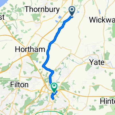
Filton Link
A cycling route starting in Tytherington, England, United Kingdom.
Overview
About this route
Links Castle Park in Bistol City Centre to the main route at Priestwood, east of Milbuty Heath. The route follows quiet roads and some cyclepaths, going through quirky St Werburghs with its Urban Farm and self build zone. It passes close to Parkway Station. A slightly less complicated alernatiive in this area is to follow Westfield Lane, then L and then R past the Station and then R into North Road to join the Filton Link.
Soon after Stoke Gifford, Old Gloucester Road is followed via Earthcott, Itchington and Tytherington. Then a climb via Baden Hill to join the main route.Â
This loop can be used in conjunction with the Commons Loop (out leg) and Easter Compton Loop (in leg).
Â
- -:--
- Duration
- 25.4 km
- Distance
- 96 m
- Ascent
- 152 m
- Descent
- ---
- Avg. speed
- ---
- Avg. speed
Route quality
Waytypes & surfaces along the route
Waytypes
Quiet road
11.7 km
(46 %)
Cycleway
6.8 km
(27 %)
Surfaces
Paved
20.5 km
(81 %)
Asphalt
20.1 km
(79 %)
Paved (undefined)
0.4 km
(2 %)
Undefined
4.8 km
(19 %)
Route highlights
Points of interest along the route
Point of interest after 14.9 km
Parkway Station is the closest mainline railway station to Avon Cycleway, The Filton Link can be reached by turning right out of the main station entrance into North Road
Continue with Bikemap
Use, edit, or download this cycling route
You would like to ride Filton Link or customize it for your own trip? Here is what you can do with this Bikemap route:
Free features
- Save this route as favorite or in collections
- Copy & plan your own version of this route
- Sync your route with Garmin or Wahoo
Premium features
Free trial for 3 days, or one-time payment. More about Bikemap Premium.
- Navigate this route on iOS & Android
- Export a GPX / KML file of this route
- Create your custom printout (try it for free)
- Download this route for offline navigation
Discover more Premium features.
Get Bikemap PremiumFrom our community
Other popular routes starting in Tytherington
- Meadowside to Parkway
- Distance
- 13.4 km
- Ascent
- 46 m
- Descent
- 80 m
- Location
- Tytherington, England, United Kingdom
- Filton Link
- Distance
- 25.4 km
- Ascent
- 96 m
- Descent
- 152 m
- Location
- Tytherington, England, United Kingdom
- Berkeley and return
- Distance
- 28.9 km
- Ascent
- 138 m
- Descent
- 137 m
- Location
- Tytherington, England, United Kingdom
- Chepstow
- Distance
- 21.1 km
- Ascent
- 149 m
- Descent
- 216 m
- Location
- Tytherington, England, United Kingdom
- Berkeley-Dursley-Wotton
- Distance
- 41.2 km
- Ascent
- 411 m
- Descent
- 411 m
- Location
- Tytherington, England, United Kingdom
- Tetbury
- Distance
- 30.5 km
- Ascent
- 237 m
- Descent
- 219 m
- Location
- Tytherington, England, United Kingdom
- Frampton on Severn
- Distance
- 29.1 km
- Ascent
- 42 m
- Descent
- 128 m
- Location
- Tytherington, England, United Kingdom
- Cromhall Lane to Blackhorse Hill, Almondsbury
- Distance
- 23.7 km
- Ascent
- 172 m
- Descent
- 235 m
- Location
- Tytherington, England, United Kingdom
Open it in the app