Biergartentour
A cycling route starting in Gensingen, Rhineland-Palatinate, Germany.
Overview
About this route
Beautiful and easy route where you can spend a lovely sunny day. Many beer and wine gardens at low prices or also exclusive. You can also swim.
- -:--
- Duration
- 73.3 km
- Distance
- 131 m
- Ascent
- 133 m
- Descent
- ---
- Avg. speed
- ---
- Max. altitude
Route quality
Waytypes & surfaces along the route
Waytypes
Cycleway
16.1 km
(22 %)
Track
11.7 km
(16 %)
Surfaces
Paved
59.4 km
(81 %)
Unpaved
3.7 km
(5 %)
Asphalt
49.9 km
(68 %)
Concrete
7.3 km
(10 %)
Route highlights
Points of interest along the route

Point of interest after 0.1 km
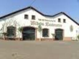
Weingut Laubenstein - Spitzenweine

Point of interest after 2 km
Weinhaus Engel

Point of interest after 8.3 km
Backhaus Lüning

Point of interest after 15.8 km
Biergarten Am Campingplatz

Point of interest after 19.8 km
Fähre Niederheimbach - Lorch

Point of interest after 30.2 km
Kone Assmannshausen

Point of interest after 44.6 km
Drosselgasse +Fähre Rüdesheim-Bingen

Point of interest after 57.6 km
Fähre Östrich Winkel - Ingelheim

Point of interest after 58.3 km
Biergarten Mole

Point of interest after 59.2 km
Strandbad

Point of interest after 62.5 km
Anglerklause

Point of interest after 66.3 km
Biergarten "Bauer Schorsch"

Point of interest after 70.3 km
Biergarten Glashaus
Continue with Bikemap
Use, edit, or download this cycling route
You would like to ride Biergartentour or customize it for your own trip? Here is what you can do with this Bikemap route:
Free features
- Save this route as favorite or in collections
- Copy & plan your own version of this route
- Sync your route with Garmin or Wahoo
Premium features
Free trial for 3 days, or one-time payment. More about Bikemap Premium.
- Navigate this route on iOS & Android
- Export a GPX / KML file of this route
- Create your custom printout (try it for free)
- Download this route for offline navigation
Discover more Premium features.
Get Bikemap PremiumFrom our community
Other popular routes starting in Gensingen
 Gensingen-Winterburg
- Distance
- 26.9 km
- Ascent
- 416 m
- Descent
- 144 m
- Location
- Gensingen, Rhineland-Palatinate, Germany
 Goldbergstraße 8, Gensingen nach Mainzer Straße 22, Gensingen
- Distance
- 80.7 km
- Ascent
- 1,210 m
- Descent
- 1,209 m
- Location
- Gensingen, Rhineland-Palatinate, Germany
 Kurztrip
- Distance
- 19.8 km
- Ascent
- 165 m
- Descent
- 139 m
- Location
- Gensingen, Rhineland-Palatinate, Germany
 Hohe Straße 15, Gensingen nach Tal 50, München
- Distance
- 444.6 km
- Ascent
- 2,844 m
- Descent
- 2,424 m
- Location
- Gensingen, Rhineland-Palatinate, Germany
 Wöllstein
- Distance
- 40.6 km
- Ascent
- 294 m
- Descent
- 294 m
- Location
- Gensingen, Rhineland-Palatinate, Germany
 Cavalgada estável
- Distance
- 18 km
- Ascent
- 104 m
- Descent
- 70 m
- Location
- Gensingen, Rhineland-Palatinate, Germany
 15.07.29 Gensingen-Dietersheim
- Distance
- 102.2 km
- Ascent
- 67 m
- Descent
- 56 m
- Location
- Gensingen, Rhineland-Palatinate, Germany
 Rheingau
- Distance
- 46.4 km
- Ascent
- 73 m
- Descent
- 77 m
- Location
- Gensingen, Rhineland-Palatinate, Germany
Open it in the app


