

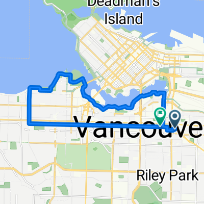
100 K Loop
A cycling route starting in Vancouver, British Columbia, Canada.
Overview
About this route
100 K Stanley-UBC-Iona-Steveston -Home
- -:--
- Duration
- 108.1 km
- Distance
- 333 m
- Ascent
- 335 m
- Descent
- ---
- Avg. speed
- ---
- Max. altitude

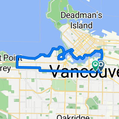
Route quality
Waytypes & surfaces along the route
Waytypes
Quiet road
37.8 km
(35 %)
Cycleway
26 km
(24 %)
Surfaces
Paved
82.2 km
(76 %)
Unpaved
8.7 km
(8 %)
Asphalt
69.2 km
(64 %)
Paved (undefined)
11.9 km
(11 %)
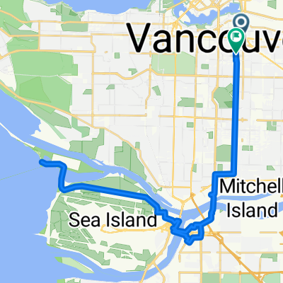
Route highlights
Points of interest along the route
Point of interest after 22 km
Continue with Bikemap
Use, edit, or download this cycling route
You would like to ride 100 K Loop or customize it for your own trip? Here is what you can do with this Bikemap route:
Free features
- Save this route as favorite or in collections
- Copy & plan your own version of this route
- Split it into stages to create a multi-day tour
- Sync your route with Garmin or Wahoo
Premium features
Free trial for 3 days, or one-time payment. More about Bikemap Premium.
- Navigate this route on iOS & Android
- Export a GPX / KML file of this route
- Create your custom printout (try it for free)
- Download this route for offline navigation
Discover more Premium features.
Get Bikemap PremiumFrom our community
Other popular routes starting in Vancouver
 233 E 11th Ave, Vancouver to 2458 Point Grey Rd, Vancouver
- Distance
- 13.4 km
- Ascent
- 119 m
- Descent
- 121 m
- Location
- Vancouver, British Columbia, Canada
 West 17th Avenue 2069, Vancouver to Stanley Park Drive 8501, Vancouver
- Distance
- 16.2 km
- Ascent
- 42 m
- Descent
- 78 m
- Location
- Vancouver, British Columbia, Canada
 Sunday Social
- Distance
- 14.3 km
- Ascent
- 119 m
- Descent
- 114 m
- Location
- Vancouver, British Columbia, Canada
 Loop: False Creek + South English Bay + 10th Ave
- Distance
- 19.5 km
- Ascent
- 208 m
- Descent
- 208 m
- Location
- Vancouver, British Columbia, Canada
 49.248, -123.150 to 49.243, -123.153
- Distance
- 26.8 km
- Ascent
- 217 m
- Descent
- 233 m
- Location
- Vancouver, British Columbia, Canada
 West 17th Avenue 2051, Vancouver to West 17th Avenue 2069, Vancouver
- Distance
- 18.7 km
- Ascent
- 129 m
- Descent
- 129 m
- Location
- Vancouver, British Columbia, Canada
 GBM - Iona Island (37 km)
- Distance
- 37.5 km
- Ascent
- 183 m
- Descent
- 175 m
- Location
- Vancouver, British Columbia, Canada
 UBC Faslse Creek
- Distance
- 40 km
- Ascent
- 384 m
- Descent
- 384 m
- Location
- Vancouver, British Columbia, Canada
Open it in the app