

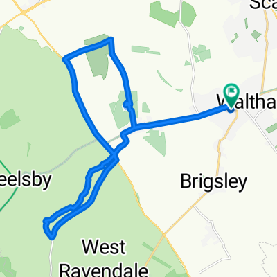
55 Southwold Crescent, Grimsby to Brough Railway Station, Station Road, Brough
A cycling route starting in Waltham, England, United Kingdom.
Overview
About this route
- 3 h 14 min
- Duration
- 53.2 km
- Distance
- 318 m
- Ascent
- 330 m
- Descent
- 16.4 km/h
- Avg. speed
- ---
- Max. altitude

Route quality
Waytypes & surfaces along the route
Waytypes
Road
23.5 km
(44 %)
Cycleway
11 km
(21 %)
Surfaces
Paved
18.3 km
(34 %)
Asphalt
18.2 km
(34 %)
Concrete
0.1 km
(<1 %)
Undefined
34.9 km
(66 %)
Continue with Bikemap
Use, edit, or download this cycling route
You would like to ride 55 Southwold Crescent, Grimsby to Brough Railway Station, Station Road, Brough or customize it for your own trip? Here is what you can do with this Bikemap route:
Free features
- Save this route as favorite or in collections
- Copy & plan your own version of this route
- Sync your route with Garmin or Wahoo
Premium features
Free trial for 3 days, or one-time payment. More about Bikemap Premium.
- Navigate this route on iOS & Android
- Export a GPX / KML file of this route
- Create your custom printout (try it for free)
- Download this route for offline navigation
Discover more Premium features.
Get Bikemap PremiumFrom our community
Other popular routes starting in Waltham
 Wolds1
- Distance
- 44.2 km
- Ascent
- 423 m
- Descent
- 423 m
- Location
- Waltham, England, United Kingdom
 Marian Way 35, Waltham to Marian Way 35, Waltham
- Distance
- 18.1 km
- Ascent
- 133 m
- Descent
- 131 m
- Location
- Waltham, England, United Kingdom
 mmmmmmm
- Distance
- 1.9 km
- Ascent
- 4 m
- Descent
- 0 m
- Location
- Waltham, England, United Kingdom
 13 Laburnum Ave, Grimsby to 13 Laburnum Ave, Grimsby
- Distance
- 18.2 km
- Ascent
- 30 m
- Descent
- 31 m
- Location
- Waltham, England, United Kingdom
 Wold loop
- Distance
- 43.9 km
- Ascent
- 407 m
- Descent
- 408 m
- Location
- Waltham, England, United Kingdom
 Covenham Reservoir Route
- Distance
- 39 km
- Ascent
- 70 m
- Descent
- 70 m
- Location
- Waltham, England, United Kingdom
 10 Laburnum Ave, Grimsby to 11 Laburnum Ave, Grimsby
- Distance
- 10.2 km
- Ascent
- 251 m
- Descent
- 249 m
- Location
- Waltham, England, United Kingdom
 Recorded via Apple Watch - 18/04/2021, 15:56
- Distance
- 7.4 km
- Ascent
- 7 m
- Descent
- 17 m
- Location
- Waltham, England, United Kingdom
Open it in the app