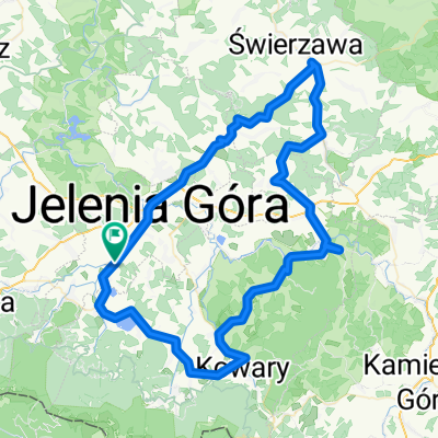


Poudnie Jeleniej Góry
- 84.6 km
- 1,220 m
- 1,219 m
- Cieplice Śląskie Zdrój, Lower Silesian Voivodeship, Poland
A cycling route starting in Cieplice Śląskie Zdrój, Lower Silesian Voivodeship, Poland.
Overview
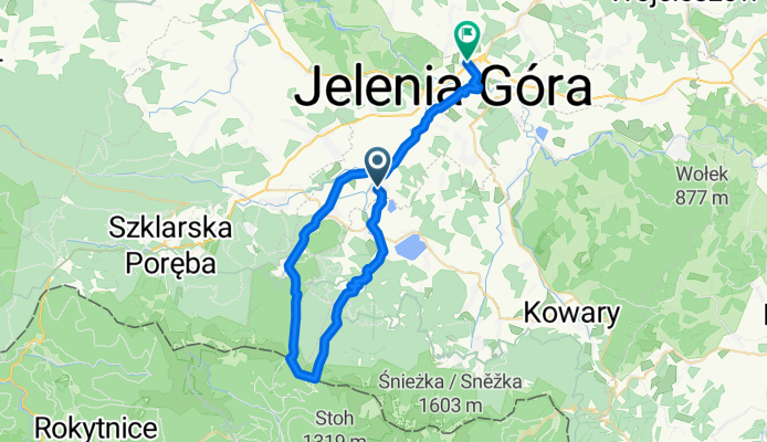
Uphill to Odrodzenie and descent on the black trail to Jagniątków. The descent is quite steep.
created this 15 years ago
Route quality
Road
13.1 km
(34 %)
Track
9.6 km
(25 %)
Paved
25.4 km
(66 %)
Unpaved
5.4 km
(14 %)
Asphalt
24.6 km
(64 %)
Gravel
2.7 km
(7 %)
Continue with Bikemap
You would like to ride Odrodzenie or customize it for your own trip? Here is what you can do with this Bikemap route:
Free trial for 3 days, or one-time payment. More about Bikemap Premium.
Discover more Premium features.
Get Bikemap PremiumFrom our community
Open it in the app