

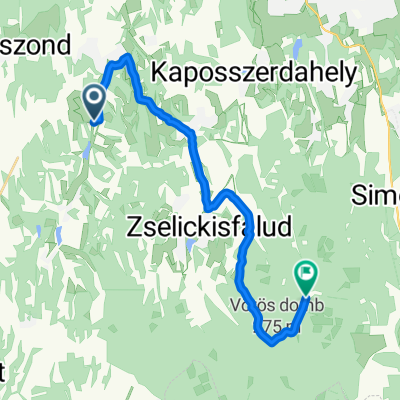
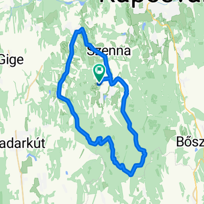
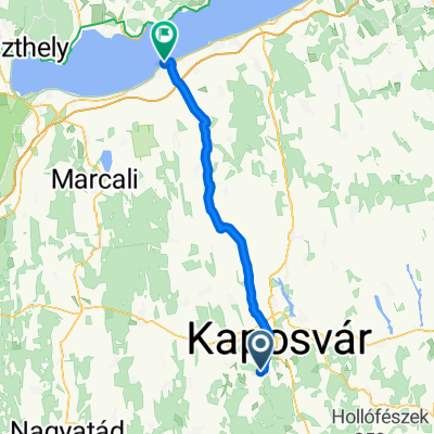
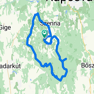
Zselici bringatúra 2020
A cycling route starting in Kaposmérő, Somogy County, Hungary.
Overview
About this route
It was a nice little tour with Erika, Feri, and András. In some places it was difficult to find the way, and sometimes the tourist trail got lost in the bushes!
- -:--
- Duration
- 62 km
- Distance
- 417 m
- Ascent
- 418 m
- Descent
- ---
- Avg. speed
- ---
- Max. altitude

Route quality
Waytypes & surfaces along the route
Waytypes
Quiet road
23.6 km
(38 %)
Track
20.5 km
(33 %)
Surfaces
Paved
32.2 km
(52 %)
Unpaved
10.5 km
(17 %)
Asphalt
24.8 km
(40 %)
Concrete
6.8 km
(11 %)
Continue with Bikemap
Use, edit, or download this cycling route
You would like to ride Zselici bringatúra 2020 or customize it for your own trip? Here is what you can do with this Bikemap route:
Free features
- Save this route as favorite or in collections
- Copy & plan your own version of this route
- Sync your route with Garmin or Wahoo
Premium features
Free trial for 3 days, or one-time payment. More about Bikemap Premium.
- Navigate this route on iOS & Android
- Export a GPX / KML file of this route
- Create your custom printout (try it for free)
- Download this route for offline navigation
Discover more Premium features.
Get Bikemap PremiumFrom our community
Other popular routes starting in Kaposmérő
 Zsippó lakótelep, Bárdudvarnok - Dél-Dunántúli Pilos Túra, Bőszénfa
- Distance
- 19.1 km
- Ascent
- 260 m
- Descent
- 250 m
- Location
- Kaposmérő, Somogy County, Hungary
 Zselic kör
- Distance
- 43.3 km
- Ascent
- 522 m
- Descent
- 520 m
- Location
- Kaposmérő, Somogy County, Hungary
 Kossuth Lajos utca 5, Szenna - Rákóczi Ferenc utca 1, Szenna
- Distance
- 21.2 km
- Ascent
- 228 m
- Descent
- 229 m
- Location
- Kaposmérő, Somogy County, Hungary
 Zselic_(K18)_75km (2)
- Distance
- 73.9 km
- Ascent
- 432 m
- Descent
- 441 m
- Location
- Kaposmérő, Somogy County, Hungary
 Kaposvár - Fonyód
- Distance
- 58 km
- Ascent
- 239 m
- Descent
- 285 m
- Location
- Kaposmérő, Somogy County, Hungary
 Szenna, tető - Magyarország, Zselickisfalud
- Distance
- 9.3 km
- Ascent
- 318 m
- Descent
- 147 m
- Location
- Kaposmérő, Somogy County, Hungary
 Patca - Patca
- Distance
- 47 km
- Ascent
- 472 m
- Descent
- 467 m
- Location
- Kaposmérő, Somogy County, Hungary
 Zselic nagykör CLONED FROM ROUTE 1008991
- Distance
- 77.7 km
- Ascent
- 631 m
- Descent
- 631 m
- Location
- Kaposmérő, Somogy County, Hungary
Open it in the app