- 60.9 km
- 1,520 m
- 924 m
- Tiefencastel, Grisons, Switzerland
Zum höchstgelegenen Dorf Europas (Juf)
A cycling route starting in Tiefencastel, Grisons, Switzerland.
Overview
About this route
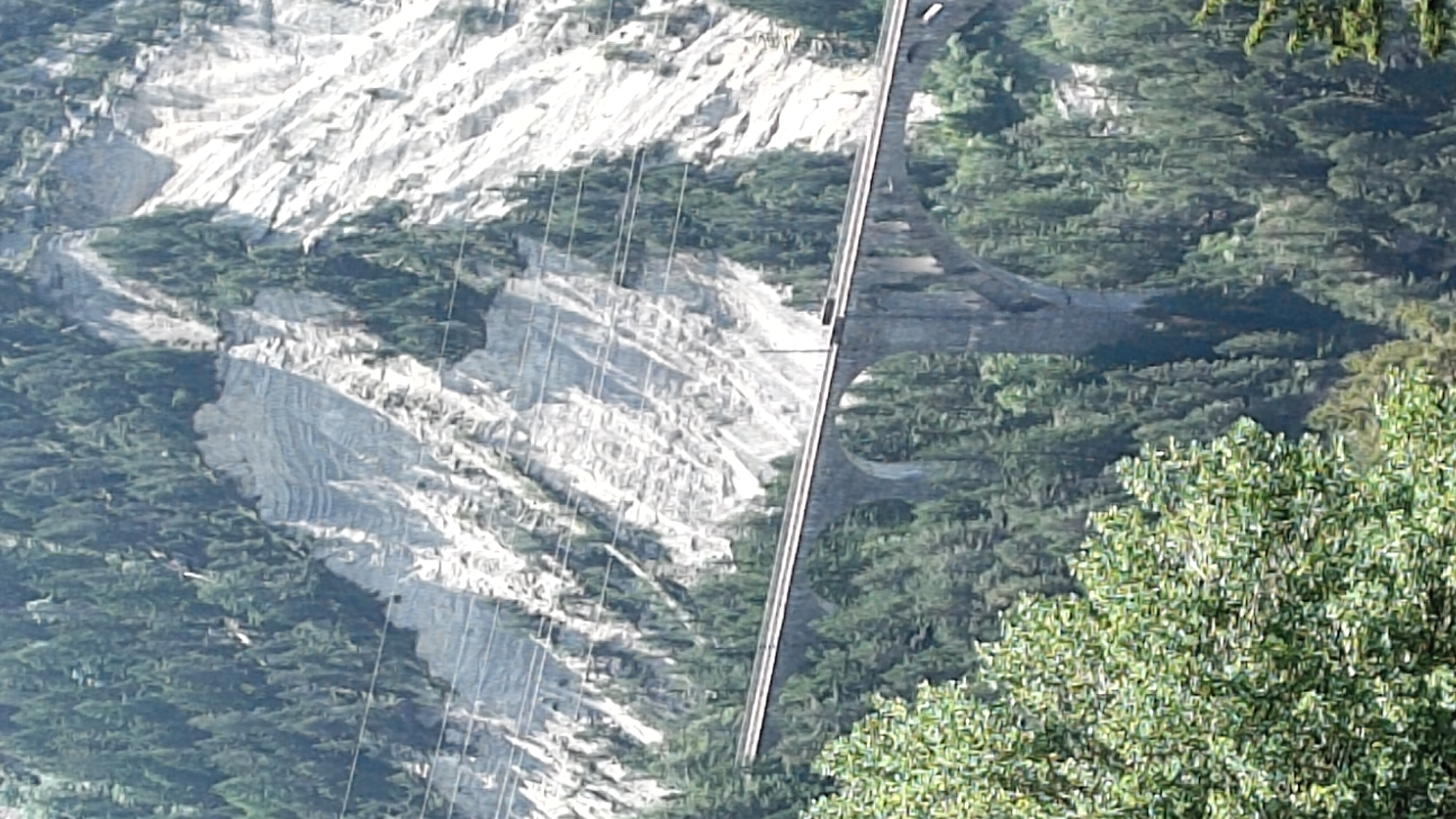
Von Alvaneu-Bad bis Tiefencastel.
Von dort bis Thusis mit der Bahn, wegen der langen Tunnel zwischen Tiefencastel und Thusis.
Von Thusis aus bis Juf wieder mit Rad.
Das gleiche zurück!
- -:--
- Duration
- 114.9 km
- Distance
- 2,365 m
- Ascent
- 2,365 m
- Descent
- ---
- Avg. speed
- ---
- Max. altitude
created this 15 years ago
Route quality
Waytypes & surfaces along the route
Waytypes
Road
42.5 km
(37 %)
Track
12.6 km
(11 %)
Surfaces
Paved
104.6 km
(91 %)
Unpaved
8 km
(7 %)
Asphalt
98.8 km
(86 %)
Paved (undefined)
5.7 km
(5 %)
Route highlights
Points of interest along the route

Point of interest after 57.4 km
Avers-Juf...das höchstgelegene ganzjährig bewohnte Dorf Europas!!!

Point of interest after 114.9 km
Trattoria Caroline sehr gute Unterkunftsmöglichkeit!!!
Continue with Bikemap
Use, edit, or download this cycling route
You would like to ride Zum höchstgelegenen Dorf Europas (Juf) or customize it for your own trip? Here is what you can do with this Bikemap route:
Free features
- Save this route as favorite or in collections
- Copy & plan your own version of this route
- Split it into stages to create a multi-day tour
- Sync your route with Garmin or Wahoo
Premium features
Free trial for 3 days, or one-time payment. More about Bikemap Premium.
- Navigate this route on iOS & Android
- Export a GPX / KML file of this route
- Create your custom printout (try it for free)
- Download this route for offline navigation
Discover more Premium features.
Get Bikemap PremiumFrom our community
Other popular routes starting in Tiefencastel
- Grisons 2015 J1
- Grisons 2015 J1
- 60.9 km
- 1,517 m
- 921 m
- Tiefencastel, Grisons, Switzerland
- Schmitten Puchi - Wiesen Bärentritt
- 7.6 km
- 214 m
- 221 m
- Tiefencastel, Grisons, Switzerland
- Savognin - Sta. Maria Val Müstair
- 109.5 km
- 4,089 m
- 3,917 m
- Tiefencastel, Grisons, Switzerland
- ewz Alpen Challenge (Classic)
- 117.3 km
- 2,547 m
- 2,543 m
- Tiefencastel, Grisons, Switzerland
- Bergün - Moia
- 111.6 km
- 3,394 m
- 4,343 m
- Tiefencastel, Grisons, Switzerland
- 115 2008.02 Albula-Bernina 9.8. u. 10.8.2008
- 110.4 km
- 2,486 m
- 2,958 m
- Tiefencastel, Grisons, Switzerland
- Filisur - Malans
- 128.3 km
- 2,370 m
- 2,784 m
- Tiefencastel, Grisons, Switzerland
Open it in the app


