
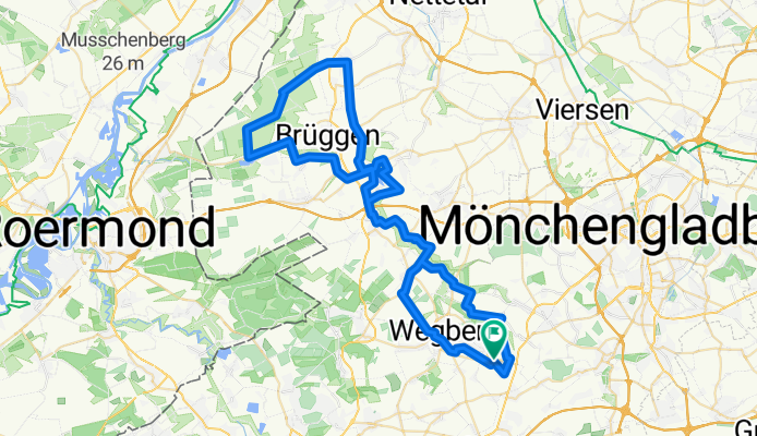
Moorshoven - Brachter Wald
A cycling route starting in Wegberg, North Rhine-Westphalia, Germany.
Overview
About this route
Niederrhein pur
- -:--
- Duration
- 68.5 km
- Distance
- 309 m
- Ascent
- 310 m
- Descent
- ---
- Avg. speed
- 75 m
- Max. altitude

Route quality
Waytypes & surfaces along the route
Waytypes
Quiet road
29.1 km
(43 %)
Road
16.3 km
(24 %)
Surfaces
Paved
28.5 km
(42 %)
Unpaved
0.2 km
(<1 %)
Asphalt
24.5 km
(36 %)
Paved (undefined)
3 km
(4 %)
Continue with Bikemap
Use, edit, or download this cycling route
You would like to ride Moorshoven - Brachter Wald or customize it for your own trip? Here is what you can do with this Bikemap route:
Free features
- Save this route as favorite or in collections
- Copy & plan your own version of this route
- Sync your route with Garmin or Wahoo
Premium features
Free trial for 3 days, or one-time payment. More about Bikemap Premium.
- Navigate this route on iOS & Android
- Export a GPX / KML file of this route
- Create your custom printout (try it for free)
- Download this route for offline navigation
Discover more Premium features.
Get Bikemap PremiumFrom our community
Other popular routes starting in Wegberg
 RTF Rheindahlen Zweiländerfahrt 72,7km
- Distance
- 72.6 km
- Ascent
- 159 m
- Descent
- 152 m
- Location
- Wegberg, North Rhine-Westphalia, Germany
 Wegberg Garzweiler Tagebau
- Distance
- 21.1 km
- Ascent
- 76 m
- Descent
- 36 m
- Location
- Wegberg, North Rhine-Westphalia, Germany
 Dag 4 onsdag 4.7.18
- Distance
- 222.9 km
- Ascent
- 520 m
- Descent
- 478 m
- Location
- Wegberg, North Rhine-Westphalia, Germany
 Mühlenroute CLONED FROM ROUTE 353682
- Distance
- 36.1 km
- Ascent
- 83 m
- Descent
- 82 m
- Location
- Wegberg, North Rhine-Westphalia, Germany
 NR914: Wegberger Mühlentour
- Distance
- 43 km
- Ascent
- 180 m
- Descent
- 178 m
- Location
- Wegberg, North Rhine-Westphalia, Germany
 27.09.2020 Wegberg, Schwanenberg, Erkelenz, Wegberg
- Distance
- 32.1 km
- Ascent
- 189 m
- Descent
- 186 m
- Location
- Wegberg, North Rhine-Westphalia, Germany
 Schwalm-Nette Maas Radtour
- Distance
- 62.6 km
- Ascent
- 74 m
- Descent
- 116 m
- Location
- Wegberg, North Rhine-Westphalia, Germany
 Mühlentur
- Distance
- 16.9 km
- Ascent
- 357 m
- Descent
- 320 m
- Location
- Wegberg, North Rhine-Westphalia, Germany
Open it in the app