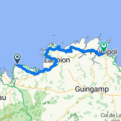
T2-Costa a Dinard
A cycling route starting in Plougasnou, Brittany Region, France.
Overview
About this route
- -:--
- Duration
- 279.2 km
- Distance
- 802 m
- Ascent
- 852 m
- Descent
- ---
- Avg. speed
- ---
- Max. altitude
Route quality
Waytypes & surfaces along the route
Waytypes
Quiet road
145.2 km
(52 %)
Road
72.6 km
(26 %)
Surfaces
Paved
131.2 km
(47 %)
Unpaved
22.3 km
(8 %)
Asphalt
128.4 km
(46 %)
Gravel
14 km
(5 %)
Continue with Bikemap
Use, edit, or download this cycling route
You would like to ride T2-Costa a Dinard or customize it for your own trip? Here is what you can do with this Bikemap route:
Free features
- Save this route as favorite or in collections
- Copy & plan your own version of this route
- Split it into stages to create a multi-day tour
- Sync your route with Garmin or Wahoo
Premium features
Free trial for 3 days, or one-time payment. More about Bikemap Premium.
- Navigate this route on iOS & Android
- Export a GPX / KML file of this route
- Create your custom printout (try it for free)
- Download this route for offline navigation
Discover more Premium features.
Get Bikemap PremiumFrom our community
Other popular routes starting in Plougasnou
- EV4 - Morlaix - Plougasnou
- Distance
- 26.1 km
- Ascent
- 245 m
- Descent
- 304 m
- Location
- Plougasnou, Brittany Region, France
- De Kervourc’H 246, Guimaëc à Rue Pors ar Villiec 13B, Locquirec
- Distance
- 10.5 km
- Ascent
- 102 m
- Descent
- 167 m
- Location
- Plougasnou, Brittany Region, France
- De Rue du Port 33, Plougasnou à Rue du Port 33, Plougasnou
- Distance
- 26.2 km
- Ascent
- 367 m
- Descent
- 366 m
- Location
- Plougasnou, Brittany Region, France
- St Jean - Derval
- Distance
- 259.5 km
- Ascent
- 660 m
- Descent
- 668 m
- Location
- Plougasnou, Brittany Region, France
- De Chemin de Lezouzard 28, Plougasnou à Kerdreïn 115, Saint-Jean-du-Doigt
- Distance
- 4.2 km
- Ascent
- 71 m
- Descent
- 83 m
- Location
- Plougasnou, Brittany Region, France
- Plougasnou- Saint Quay Portrieux 0506
- Distance
- 199.7 km
- Ascent
- 798 m
- Descent
- 783 m
- Location
- Plougasnou, Brittany Region, France
- De Rue de Pors Louarn 14, Plougasnou à Chemin de Lezouzard 28, Plougasnou
- Distance
- 5.7 km
- Ascent
- 98 m
- Descent
- 32 m
- Location
- Plougasnou, Brittany Region, France
- Jour 7: Plougasnou - Plestin-les-greves
- Distance
- 26.5 km
- Ascent
- 410 m
- Descent
- 352 m
- Location
- Plougasnou, Brittany Region, France
Open it in the app