

Stourhead loop
A cycling route starting in Kilmington, England, United Kingdom.
Overview
About this route
This is a circular walk of historic interest which takes you up through beautiful woodlands to King Alfred’s Tower and returning through Park Hill Camp Iron Age Hill Fort and Turner’s Paddock. King Alfred’s Tower is a 160ft (49m) high folly, designed by Henry Flitcroft for Henry Hoare II in 1772. It is believed to mark the site where King Alfred the Great rallied his troops in 878. The tower commemorates the accession of George III to the throne in 1760 and the end of the Seven Years War.
- -:--
- Duration
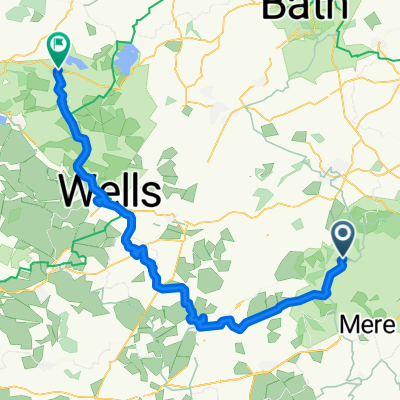
- 37.5 km
- Distance
- 513 m
- Ascent
- 512 m
- Descent
- ---
- Avg. speed
- ---
- Max. altitude

Route quality
Waytypes & surfaces along the route
Waytypes
Cycleway
12.6 km
(34 %)
Track
7.5 km
(20 %)
Surfaces
Paved
1 km
(3 %)
Unpaved
4.7 km
(13 %)
Ground
3.1 km
(8 %)
Gravel
1.2 km
(3 %)
Continue with Bikemap
Use, edit, or download this cycling route
You would like to ride Stourhead loop or customize it for your own trip? Here is what you can do with this Bikemap route:
Free features
- Save this route as favorite or in collections
- Copy & plan your own version of this route
- Sync your route with Garmin or Wahoo
Premium features
Free trial for 3 days, or one-time payment. More about Bikemap Premium.
- Navigate this route on iOS & Android
- Export a GPX / KML file of this route
- Create your custom printout (try it for free)
- Download this route for offline navigation
Discover more Premium features.
Get Bikemap PremiumFrom our community
Other popular routes starting in Kilmington
 Day10B_9C
- Distance
- 85.3 km
- Ascent
- 690 m
- Descent
- 885 m
- Location
- Kilmington, England, United Kingdom
 King Alfreds Tower to Frome
- Distance
- 23.5 km
- Ascent
- 284 m
- Descent
- 434 m
- Location
- Kilmington, England, United Kingdom
 Tower Road, Kilmington, Warminster to A371, Ditcheat, Evercreech, Shepton Mallet
- Distance
- 17.9 km
- Ascent
- 1,028 m
- Descent
- 1,193 m
- Location
- Kilmington, England, United Kingdom
 Sourhead to campsite via mere
- Distance
- 8.5 km
- Ascent
- 14 m
- Descent
- 97 m
- Location
- Kilmington, England, United Kingdom
 Kilmington Common, Kilmington, Warminster to A361, Cranmore, East Cranmore, Shepton Mallet
- Distance
- 17.3 km
- Ascent
- 297 m
- Descent
- 346 m
- Location
- Kilmington, England, United Kingdom
 Kilmington - Blagdon
- Distance
- 64.4 km
- Ascent
- 781 m
- Descent
- 842 m
- Location
- Kilmington, England, United Kingdom
 Stourhead loop
- Distance
- 37.5 km
- Ascent
- 513 m
- Descent
- 512 m
- Location
- Kilmington, England, United Kingdom
 Figure_of_Hate
- Distance
- 33.3 km
- Ascent
- 419 m
- Descent
- 418 m
- Location
- Kilmington, England, United Kingdom
Open it in the app