

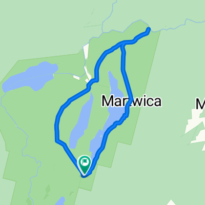
3.Tuczno, Sówka, Bogdanka i z powrotem...
A cycling route starting in Tuczno, West Pomeranian Voivodeship, Poland.
Overview
About this route
- -:--
- Duration
- 50.5 km
- Distance
- 190 m
- Ascent
- 196 m
- Descent
- ---
- Avg. speed
- ---
- Max. altitude

Route quality
Waytypes & surfaces along the route
Waytypes
Track
39.4 km
(78 %)
Quiet road
10.6 km
(21 %)
Undefined
0.5 km
(1 %)
Surfaces
Paved
24.8 km
(49 %)
Unpaved
20.2 km
(40 %)
Paved (undefined)
18.7 km
(37 %)
Gravel
10.1 km
(20 %)
Route highlights
Points of interest along the route
Drinking water after 7.3 km
Drinking water after 12.6 km
Drinking water after 15 km
Drinking water after 21.7 km
Drinking water after 25.6 km
Drinking water after 32.1 km
Drinking water after 39.4 km
Continue with Bikemap
Use, edit, or download this cycling route
You would like to ride 3.Tuczno, Sówka, Bogdanka i z powrotem... or customize it for your own trip? Here is what you can do with this Bikemap route:
Free features
- Save this route as favorite or in collections
- Copy & plan your own version of this route
- Sync your route with Garmin or Wahoo
Premium features
Free trial for 3 days, or one-time payment. More about Bikemap Premium.
- Navigate this route on iOS & Android
- Export a GPX / KML file of this route
- Create your custom printout (try it for free)
- Download this route for offline navigation
Discover more Premium features.
Get Bikemap PremiumFrom our community
Other popular routes starting in Tuczno
 tuczno barlinek
- Distance
- 88.9 km
- Ascent
- 128 m
- Descent
- 161 m
- Location
- Tuczno, West Pomeranian Voivodeship, Poland
 3.Tuczno, Sówka, Bogdanka i z powrotem...
- Distance
- 50.5 km
- Ascent
- 190 m
- Descent
- 196 m
- Location
- Tuczno, West Pomeranian Voivodeship, Poland
 strzaliny mirosławiec
- Distance
- 24.3 km
- Ascent
- 131 m
- Descent
- 105 m
- Location
- Tuczno, West Pomeranian Voivodeship, Poland
 DPN północ Na nogach
- Distance
- 10.8 km
- Ascent
- 104 m
- Descent
- 104 m
- Location
- Tuczno, West Pomeranian Voivodeship, Poland
 Wyścig dookoła Polski Prolog Tuczno
- Distance
- 6.5 km
- Ascent
- 17 m
- Descent
- 50 m
- Location
- Tuczno, West Pomeranian Voivodeship, Poland
 Strzaliny - Miłogoszcz
- Distance
- 7.1 km
- Ascent
- 56 m
- Descent
- 90 m
- Location
- Tuczno, West Pomeranian Voivodeship, Poland
 Drawieński Park Narodowy
- Distance
- 49.4 km
- Ascent
- 164 m
- Descent
- 182 m
- Location
- Tuczno, West Pomeranian Voivodeship, Poland
 drawieński park narodowy
- Distance
- 33.9 km
- Ascent
- 305 m
- Descent
- 305 m
- Location
- Tuczno, West Pomeranian Voivodeship, Poland
Open it in the app