

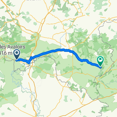
Jour 01
A cycling route starting in Saint-Denis-sur-Sarthon, Normandy, France.
Overview
About this route
- 6 h 1 min
- Duration
- 98.2 km
- Distance
- 1,022 m
- Ascent
- 1,129 m
- Descent
- 16.3 km/h
- Avg. speed
- ---
- Max. altitude
Route quality
Waytypes & surfaces along the route
Waytypes
Road
61.9 km
(63 %)
Quiet road
17.7 km
(18 %)
Surfaces
Paved
57 km
(58 %)
Unpaved
3.9 km
(4 %)
Asphalt
57 km
(58 %)
Gravel
3.9 km
(4 %)
Undefined
37.3 km
(38 %)
Continue with Bikemap
Use, edit, or download this cycling route
You would like to ride Jour 01 or customize it for your own trip? Here is what you can do with this Bikemap route:
Free features
- Save this route as favorite or in collections
- Copy & plan your own version of this route
- Split it into stages to create a multi-day tour
- Sync your route with Garmin or Wahoo
Premium features
Free trial for 3 days, or one-time payment. More about Bikemap Premium.
- Navigate this route on iOS & Android
- Export a GPX / KML file of this route
- Create your custom printout (try it for free)
- Download this route for offline navigation
Discover more Premium features.
Get Bikemap PremiumFrom our community
Other popular routes starting in Saint-Denis-sur-Sarthon
 12. Saint Ellier les bois - Vitré
- Distance
- 140.9 km
- Ascent
- 511 m
- Descent
- 693 m
- Location
- Saint-Denis-sur-Sarthon, Normandy, France
 De Rue de la Billardière 21, La Ferrière-Bochard à Rue des Alpes Mancelles 24, La Ferrière-Bochard
- Distance
- 10.3 km
- Ascent
- 164 m
- Descent
- 175 m
- Location
- Saint-Denis-sur-Sarthon, Normandy, France
 105 La Grande Vigne, La Roche-Mabile to 74–82 Chemin des Maures, Alençon
- Distance
- 13.5 km
- Ascent
- 60 m
- Descent
- 127 m
- Location
- Saint-Denis-sur-Sarthon, Normandy, France
 De Rue des Alpes Mancelles 24, La Ferrière-Bochard à Rue des Alpes Mancelles 17, La Ferrière-Bochard
- Distance
- 16.6 km
- Ascent
- 149 m
- Descent
- 134 m
- Location
- Saint-Denis-sur-Sarthon, Normandy, France
 Rouperroux Loop
- Distance
- 15.3 km
- Ascent
- 225 m
- Descent
- 224 m
- Location
- Saint-Denis-sur-Sarthon, Normandy, France
 Saint-Denis-sur-Sarthon - Condé-sur-Huisne
- Distance
- 74.8 km
- Ascent
- 321 m
- Descent
- 403 m
- Location
- Saint-Denis-sur-Sarthon, Normandy, France
 La Ferriére-Béchet Loop
- Distance
- 32.4 km
- Ascent
- 674 m
- Descent
- 673 m
- Location
- Saint-Denis-sur-Sarthon, Normandy, France
 N12 82, Saint-Denis-sur-Sarthon to Avenue Pierre de Coubertin 109, Laval
- Distance
- 113.3 km
- Ascent
- 1,913 m
- Descent
- 2,027 m
- Location
- Saint-Denis-sur-Sarthon, Normandy, France
Open it in the app