

Cykelrute - Ore Strand Camp-Faxe Ladeplads C-Vemmetofte Strand C-Lægårdens C-Rødvig C-Stevns Camp
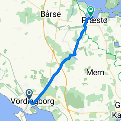
A cycling route starting in Vordingborg, Region Zealand, Denmark.
Overview
About this route
- -:--
- Duration
- 92 km
- Distance
- 200 m
- Ascent
- 193 m
- Descent
- ---
- Avg. speed
- ---
- Max. altitude

Route quality
Waytypes & surfaces along the route
Waytypes
Road
41.4 km
(45 %)
Quiet road
31.3 km
(34 %)
Surfaces
Paved
81.9 km
(89 %)
Unpaved
4.6 km
(5 %)
Asphalt
81.9 km
(89 %)
Gravel
2.8 km
(3 %)
Route highlights
Points of interest along the route
Accommodation after 0.1 km
Ore Strand Camping - 73 km fra Nakskov - 3 km omvej.
Accommodation after 40 km
Faxe Ladeplads Camping - 40 km fra Ore Strand Camping
Accommodation after 45.5 km
Vemmetofte Strand Camping - 45 km fra Ore Strand Camping
Accommodation after 49.3 km
Lægårdens Camping - 50 km fra Ore Strand Camping
Accommodation after 62.4 km
Rødvig Camping - 60 km fra Ore Strand Camping
Drinking water after 90.2 km
Circle K - Mad
Drinking water after 90.5 km
Circle K - Mad
Accommodation after 92 km
Stevns Camping
Continue with Bikemap
Use, edit, or download this cycling route
You would like to ride Cykelrute - Ore Strand Camp-Faxe Ladeplads C-Vemmetofte Strand C-Lægårdens C-Rødvig C-Stevns Camp or customize it for your own trip? Here is what you can do with this Bikemap route:
Free features
- Save this route as favorite or in collections
- Copy & plan your own version of this route
- Split it into stages to create a multi-day tour
- Sync your route with Garmin or Wahoo
Premium features
Free trial for 3 days, or one-time payment. More about Bikemap Premium.
- Navigate this route on iOS & Android
- Export a GPX / KML file of this route
- Create your custom printout (try it for free)
- Download this route for offline navigation
Discover more Premium features.
Get Bikemap PremiumFrom our community
Other popular routes starting in Vordingborg
 Cykelrute - Ore Strand Camp-Faxe Ladeplads C-Vemmetofte Strand C-Lægårdens C-Rødvig C-Stevns Camp
- Distance
- 92 km
- Ascent
- 200 m
- Descent
- 193 m
- Location
- Vordingborg, Region Zealand, Denmark
 Cykelrute - Gravel - Vordingborg Station-Ovstrup Skov på Falster-Lollands sydside-Nakskov
- Distance
- 166.3 km
- Ascent
- 48 m
- Descent
- 50 m
- Location
- Vordingborg, Region Zealand, Denmark
 Kuskevej 19, Vordingborg to Kuskevej 15, Vordingborg
- Distance
- 36.2 km
- Ascent
- 22 m
- Descent
- 27 m
- Location
- Vordingborg, Region Zealand, Denmark
 Iceland: 2009-08-13
- Distance
- 187.6 km
- Ascent
- 269 m
- Descent
- 236 m
- Location
- Vordingborg, Region Zealand, Denmark
 Løberute - Ore Strand Camp-mod nordvest
- Distance
- 20.4 km
- Ascent
- 19 m
- Descent
- 17 m
- Location
- Vordingborg, Region Zealand, Denmark
 Rute 8 vordingborg næstved
- Distance
- 41.2 km
- Ascent
- 71 m
- Descent
- 67 m
- Location
- Vordingborg, Region Zealand, Denmark
 Cykelrute - Gravel - Vordingborg Station-Guldborg Sunds vestside-Nysted-Lollands sydside-Nakskov
- Distance
- 173.1 km
- Ascent
- 50 m
- Descent
- 50 m
- Location
- Vordingborg, Region Zealand, Denmark
 Importierte Route
- Distance
- 18.4 km
- Ascent
- 109 m
- Descent
- 110 m
- Location
- Vordingborg, Region Zealand, Denmark
Open it in the app