

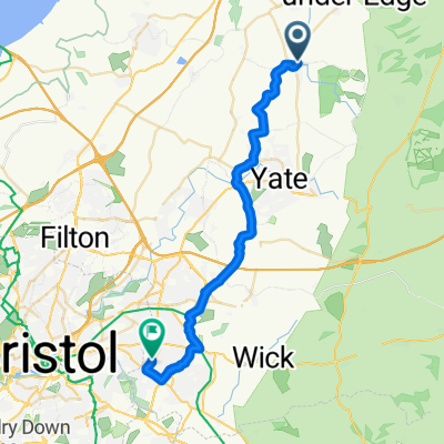
Avon Cycleway sections
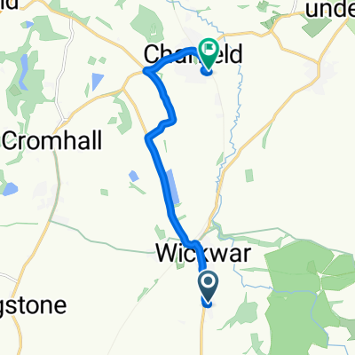
Wickwar to Littleton on Severn
A cycling route starting in Wickwar, England, United Kingdom.
Overview
About this route
From the Wciwar Coffee Shop on the High Street, to the White Hart, Littleton on Severn
- -:--
- Duration
- 18.5 km
- Distance
- 124 m
- Ascent
- 195 m
- Descent
- ---
- Avg. speed
- ---
- Max. altitude

Part of
Avon Cycleway sections
18 stages
Route quality
Waytypes & surfaces along the route
Waytypes
Quiet road
16.2 km
(88 %)
Undefined
2.2 km
(12 %)
Surfaces
Paved
7 km
(38 %)
Asphalt
7 km
(38 %)
Undefined
11.4 km
(62 %)
Continue with Bikemap
Use, edit, or download this cycling route
You would like to ride Wickwar to Littleton on Severn or customize it for your own trip? Here is what you can do with this Bikemap route:
Free features
- Save this route as favorite or in collections
- Copy & plan your own version of this route
- Sync your route with Garmin or Wahoo
Premium features
Free trial for 3 days, or one-time payment. More about Bikemap Premium.
- Navigate this route on iOS & Android
- Export a GPX / KML file of this route
- Create your custom printout (try it for free)
- Download this route for offline navigation
Discover more Premium features.
Get Bikemap PremiumFrom our community
Other popular routes starting in Wickwar
 Wickwar
- Distance
- 19.7 km
- Ascent
- 118 m
- Descent
- 120 m
- Location
- Wickwar, England, United Kingdom
 Daily Training Route
- Distance
- 20.1 km
- Ascent
- 142 m
- Descent
- 141 m
- Location
- Wickwar, England, United Kingdom
 2nd half to server bridge
- Distance
- 25.7 km
- Ascent
- 241 m
- Descent
- 269 m
- Location
- Wickwar, England, United Kingdom

 Sporty route in Wotton-under-Edge
- Distance
- 6.9 km
- Ascent
- 10 m
- Descent
- 60 m
- Location
- Wickwar, England, United Kingdom
 Wickwar to Littleton on Severn
- Distance
- 18.5 km
- Ascent
- 123 m
- Descent
- 194 m
- Location
- Wickwar, England, United Kingdom

 Station Road 43, Wickwar to Forest Road 43
- Distance
- 26 km
- Ascent
- 140 m
- Descent
- 131 m
- Location
- Wickwar, England, United Kingdom
Open it in the app