

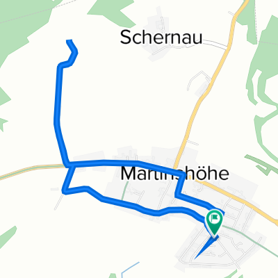
Zweibrücker Straße 67, Martinshöhe nach Zweibrücker Straße 65, Martinshöhe
A cycling route starting in Martinshöhe, Rhineland-Palatinate, Germany.
Overview
About this route
- 5 min
- Duration
- 1.5 km
- Distance
- 6 m
- Ascent
- 6 m
- Descent
- 16.8 km/h
- Avg. speed
- ---
- Avg. speed

Route quality
Waytypes & surfaces along the route
Waytypes
Busy road
1.5 km
(100 %)
Surfaces
Paved
1.5 km
(100 %)
Asphalt
1.5 km
(100 %)
Continue with Bikemap
Use, edit, or download this cycling route
You would like to ride Zweibrücker Straße 67, Martinshöhe nach Zweibrücker Straße 65, Martinshöhe or customize it for your own trip? Here is what you can do with this Bikemap route:
Free features
- Save this route as favorite or in collections
- Copy & plan your own version of this route
- Sync your route with Garmin or Wahoo
Premium features
Free trial for 3 days, or one-time payment. More about Bikemap Premium.
- Navigate this route on iOS & Android
- Export a GPX / KML file of this route
- Create your custom printout (try it for free)
- Download this route for offline navigation
Discover more Premium features.
Get Bikemap PremiumFrom our community
Other popular routes starting in Martinshöhe
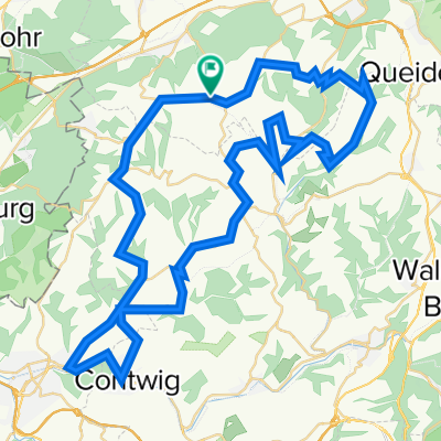
 Pfälzer Jakobsweg Nordroute, Bruchmühlbach-Miesau nach Kettelersiedlung 20, Bexbach
- Distance
- 19.6 km
- Ascent
- 350 m
- Descent
- 261 m
- Location
- Martinshöhe, Rhineland-Palatinate, Germany
 Steinkreuzer Weg 6, Martinshöhe nach Steinkreuzer Weg 6, Martinshöhe
- Distance
- 4.8 km
- Ascent
- 52 m
- Descent
- 48 m
- Location
- Martinshöhe, Rhineland-Palatinate, Germany
 Buchenweg 30, Martinshöhe nach Schillerstraße 1, Zweibrücken
- Distance
- 21.5 km
- Ascent
- 163 m
- Descent
- 345 m
- Location
- Martinshöhe, Rhineland-Palatinate, Germany
 Zweibrücker Straße 67, Martinshöhe nach Zweibrücker Straße 65, Martinshöhe
- Distance
- 1.5 km
- Ascent
- 6 m
- Descent
- 6 m
- Location
- Martinshöhe, Rhineland-Palatinate, Germany
 Steinkreuzer Weg 4, Martinshöhe nach Steinkreuzer Weg 6, Martinshöhe
- Distance
- 7.3 km
- Ascent
- 163 m
- Descent
- 162 m
- Location
- Martinshöhe, Rhineland-Palatinate, Germany
 quäl dich
- Distance
- 65.5 km
- Ascent
- 809 m
- Descent
- 809 m
- Location
- Martinshöhe, Rhineland-Palatinate, Germany
 Recovered Route
- Distance
- 8.1 km
- Ascent
- 19 m
- Descent
- 158 m
- Location
- Martinshöhe, Rhineland-Palatinate, Germany
 Schnelle Tour in Zweibrücken
- Distance
- 11 km
- Ascent
- 40 m
- Descent
- 101 m
- Location
- Martinshöhe, Rhineland-Palatinate, Germany
Open it in the app