

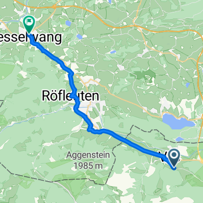
Stegen-Heiterwanger See
A cycling route starting in Vils, Tyrol, Austria.
Overview
About this route
- -:--
- Duration
- 20 km
- Distance
- 305 m
- Ascent
- 143 m
- Descent
- ---
- Avg. speed
- ---
- Max. altitude
Route quality
Waytypes & surfaces along the route
Waytypes
Quiet road
9.4 km
(47 %)
Track
4.2 km
(21 %)
Surfaces
Paved
12.6 km
(63 %)
Unpaved
2.6 km
(13 %)
Asphalt
11.8 km
(59 %)
Gravel
2.6 km
(13 %)
Continue with Bikemap
Use, edit, or download this cycling route
You would like to ride Stegen-Heiterwanger See or customize it for your own trip? Here is what you can do with this Bikemap route:
Free features
- Save this route as favorite or in collections
- Copy & plan your own version of this route
- Sync your route with Garmin or Wahoo
Premium features
Free trial for 3 days, or one-time payment. More about Bikemap Premium.
- Navigate this route on iOS & Android
- Export a GPX / KML file of this route
- Create your custom printout (try it for free)
- Download this route for offline navigation
Discover more Premium features.
Get Bikemap PremiumFrom our community
Other popular routes starting in Vils
 Stegen-Heiterwanger See
- Distance
- 20 km
- Ascent
- 305 m
- Descent
- 143 m
- Location
- Vils, Tyrol, Austria
 Vils tammheim
- Distance
- 46.6 km
- Ascent
- 367 m
- Descent
- 367 m
- Location
- Vils, Tyrol, Austria
 47.543, 10.637 nach 47.625, 10.503
- Distance
- 16.3 km
- Ascent
- 218 m
- Descent
- 191 m
- Location
- Vils, Tyrol, Austria
 Otto Mayr Hütte
- Distance
- 14.1 km
- Ascent
- 802 m
- Descent
- 97 m
- Location
- Vils, Tyrol, Austria
 Bernbeuern route
- Distance
- 57.1 km
- Ascent
- 632 m
- Descent
- 632 m
- Location
- Vils, Tyrol, Austria
 Ettape3
- Distance
- 111.2 km
- Ascent
- 1,567 m
- Descent
- 1,473 m
- Location
- Vils, Tyrol, Austria
 Weißensee-Falkenstein
- Distance
- 17 km
- Ascent
- 557 m
- Descent
- 512 m
- Location
- Vils, Tyrol, Austria
 Vils Bach Tour
- Distance
- 45.8 km
- Ascent
- 376 m
- Descent
- 347 m
- Location
- Vils, Tyrol, Austria
Open it in the app