

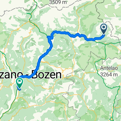
20200712 Anello di St. Magdalena Gsies
A cycling route starting in San Martino, Trentino-Alto Adige, Italy.
Overview
About this route
- -:--
- Duration
- 15.3 km
- Distance
- 558 m
- Ascent
- 560 m
- Descent
- ---
- Avg. speed
- ---
- Max. altitude

Route quality
Waytypes & surfaces along the route
Waytypes
Quiet road
6.4 km
(42 %)
Track
3.4 km
(22 %)
Surfaces
Paved
5 km
(33 %)
Unpaved
5.5 km
(36 %)
Asphalt
5 km
(33 %)
Ground
3.7 km
(24 %)
Continue with Bikemap
Use, edit, or download this cycling route
You would like to ride 20200712 Anello di St. Magdalena Gsies or customize it for your own trip? Here is what you can do with this Bikemap route:
Free features
- Save this route as favorite or in collections
- Copy & plan your own version of this route
- Sync your route with Garmin or Wahoo
Premium features
Free trial for 3 days, or one-time payment. More about Bikemap Premium.
- Navigate this route on iOS & Android
- Export a GPX / KML file of this route
- Create your custom printout (try it for free)
- Download this route for offline navigation
Discover more Premium features.
Get Bikemap PremiumFrom our community
Other popular routes starting in San Martino
 3a tappa traversata delle alpi
- Distance
- 81.4 km
- Ascent
- 422 m
- Descent
- 912 m
- Location
- San Martino, Trentino-Alto Adige, Italy
 EROICA ZAF PLUS
- Distance
- 134.8 km
- Ascent
- 2,705 m
- Descent
- 2,704 m
- Location
- San Martino, Trentino-Alto Adige, Italy
 Val Casies - giro delle malghe
- Distance
- 8.3 km
- Ascent
- 687 m
- Descent
- 687 m
- Location
- San Martino, Trentino-Alto Adige, Italy
 VAL CASIES - Monguelfo - Fortezza+Novacella - Bronx
- Distance
- 130 km
- Ascent
- 163 m
- Descent
- 1,127 m
- Location
- San Martino, Trentino-Alto Adige, Italy
 Von Antholz nach Matrei
- Distance
- 53.1 km
- Ascent
- 987 m
- Descent
- 1,328 m
- Location
- San Martino, Trentino-Alto Adige, Italy
 Lake Anterselva - Valdaora
- Distance
- 20.1 km
- Ascent
- 0 m
- Descent
- 0 m
- Location
- San Martino, Trentino-Alto Adige, Italy
 20200712 Anello di St. Magdalena Gsies
- Distance
- 15.3 km
- Ascent
- 558 m
- Descent
- 560 m
- Location
- San Martino, Trentino-Alto Adige, Italy
 20200715 Valli Casies e Anterselva
- Distance
- 62.8 km
- Ascent
- 1,535 m
- Descent
- 1,535 m
- Location
- San Martino, Trentino-Alto Adige, Italy
Open it in the app