

VT Nord
A cycling route starting in Batoş, Mureș County, Romania.
Overview
About this route
Statistics computed from imported data
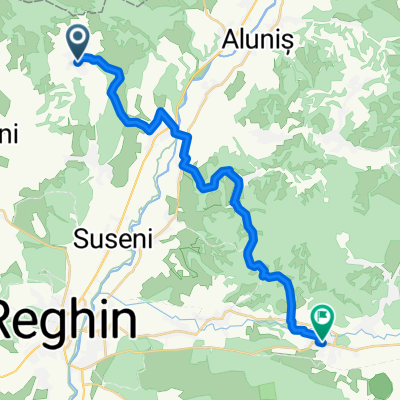
Distance: 59.2 miles Minimum Elevation: 1303 feet Maximum Elevation: 3911 feet Total climb: 7646 feet Total descent: 7647 feet
- -:--
- Duration
- 91.1 km
- Distance
- 2,598 m
- Ascent
- 2,581 m
- Descent
- ---
- Avg. speed
- ---
- Max. altitude

Continue with Bikemap
Use, edit, or download this cycling route
You would like to ride VT Nord or customize it for your own trip? Here is what you can do with this Bikemap route:
Free features
- Save this route as favorite or in collections
- Copy & plan your own version of this route
- Split it into stages to create a multi-day tour
- Sync your route with Garmin or Wahoo
Premium features
Free trial for 3 days, or one-time payment. More about Bikemap Premium.
- Navigate this route on iOS & Android
- Export a GPX / KML file of this route
- Create your custom printout (try it for free)
- Download this route for offline navigation
Discover more Premium features.
Get Bikemap PremiumFrom our community
Other popular routes starting in Batoş
 Batoş - Gurghiu
- Distance
- 24.4 km
- Ascent
- 645 m
- Descent
- 685 m
- Location
- Batoş, Mureș County, Romania
 VT Nord
- Distance
- 91.1 km
- Ascent
- 2,598 m
- Descent
- 2,581 m
- Location
- Batoş, Mureș County, Romania
 VT 2 Iunie
- Distance
- 74 km
- Ascent
- 518 m
- Descent
- 488 m
- Location
- Batoş, Mureș County, Romania
 Recording from 09 Apr 2016 12:53
- Distance
- 4.6 km
- Ascent
- 174 m
- Descent
- 202 m
- Location
- Batoş, Mureș County, Romania
 Cetatea Batosului, de la Sacalu de Padure
- Distance
- 3.1 km
- Ascent
- 273 m
- Descent
- 0 m
- Location
- Batoş, Mureș County, Romania
 VT 2 Iunie
- Distance
- 73.4 km
- Ascent
- 748 m
- Descent
- 718 m
- Location
- Batoş, Mureș County, Romania
 Turul Cramelor - Liliac
- Distance
- 11.4 km
- Ascent
- 361 m
- Descent
- 364 m
- Location
- Batoş, Mureș County, Romania
Open it in the app