

gtb 3v1
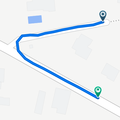
A cycling route starting in Clohars-Fouesnant, Brittany Region, France.
Overview
About this route
- -:--
- Duration
- 214.9 km
- Distance
- 633 m
- Ascent
- 537 m
- Descent
- ---
- Avg. speed
- ---
- Max. altitude

Route quality
Waytypes & surfaces along the route
Waytypes
Quiet road
62.3 km
(29 %)
Track
34.4 km
(16 %)
Surfaces
Paved
55.9 km
(26 %)
Unpaved
36.5 km
(17 %)
Asphalt
49.4 km
(23 %)
Gravel
15 km
(7 %)
Continue with Bikemap
Use, edit, or download this cycling route
You would like to ride gtb 3v1 or customize it for your own trip? Here is what you can do with this Bikemap route:
Free features
- Save this route as favorite or in collections
- Copy & plan your own version of this route
- Split it into stages to create a multi-day tour
- Sync your route with Garmin or Wahoo
Premium features
Free trial for 3 days, or one-time payment. More about Bikemap Premium.
- Navigate this route on iOS & Android
- Export a GPX / KML file of this route
- Create your custom printout (try it for free)
- Download this route for offline navigation
Discover more Premium features.
Get Bikemap PremiumFrom our community
Other popular routes starting in Clohars-Fouesnant
 17 Hent Ménez Perguet, Fouesnant à 96 Rue de l'Odet, Fouesnant
- Distance
- 3.2 km
- Ascent
- 44 m
- Descent
- 0 m
- Location
- Clohars-Fouesnant, Brittany Region, France
 De Le Drennec, Clohars-Fouesnant à 8 Rue Saint-François, Quimper
- Distance
- 11.5 km
- Ascent
- 94 m
- Descent
- 141 m
- Location
- Clohars-Fouesnant, Brittany Region, France
 1068 Kerven, Fouesnant à 96 Rue de l'Odet, Fouesnant
- Distance
- 2.9 km
- Ascent
- 38 m
- Descent
- 0 m
- Location
- Clohars-Fouesnant, Brittany Region, France
 De 110 Route de Mestrezec, Fouesnant à 2 Rue Amiral Courbet, Concarneau
- Distance
- 15.8 km
- Ascent
- 204 m
- Descent
- 207 m
- Location
- Clohars-Fouesnant, Brittany Region, France
 De 2 Le Clos de Ty Glas, Clohars-Fouesnant à 24 Route de Kerangaro, Clohars-Fouesnant
- Distance
- 0.5 km
- Ascent
- 0 m
- Descent
- 6 m
- Location
- Clohars-Fouesnant, Brittany Region, France
 Route de Mestrezec, Fouesnant to Hent Ménez Perguet, Fouesnant
- Distance
- 0.5 km
- Ascent
- 0 m
- Descent
- 0 m
- Location
- Clohars-Fouesnant, Brittany Region, France
 De Route de Fouesnant 374F, Bénodet à Route de Fouesnant 74, Bénodet
- Distance
- 25.7 km
- Ascent
- 124 m
- Descent
- 121 m
- Location
- Clohars-Fouesnant, Brittany Region, France
 place du meneyer
- Distance
- 5.5 km
- Ascent
- 45 m
- Descent
- 42 m
- Location
- Clohars-Fouesnant, Brittany Region, France
Open it in the app