

Nice route to the near villas and back to Blago
A cycling route starting in Blagoevgrad, Blagoevgrad, Bulgaria.
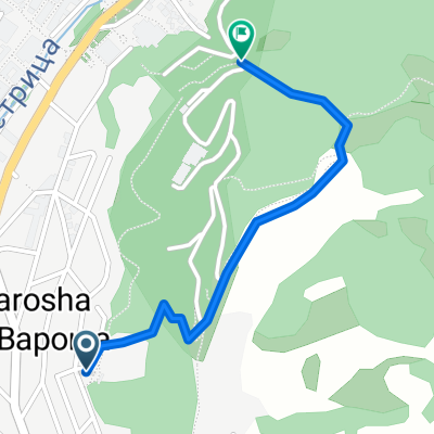
Overview
About this route
After the stadium the road is very steep, but if you have good gears and you're in shape it's ride-able since it's cemented. When you reach the top of the hill you will see a weird area-51-like building (the water supply station). Pass it on its left side and then go up. Soon you'll see some shacks and gardens on the right, on the left a nice forest. Go up the road, this section is totally secluded so don't worry to ride wild - there are no cars. At some point you'll reach a dusty intersection near some houses, take left and then ride through the village. Beware the dogs and enjoy the speed. Again the cars are pretty few, but be careful. The road gets pretty curvy about two km. before Blago - there I advise you to slow down and be careful for crazy drivers.
It's a nice one - great progression and change of scenery.
Safe riding!
- -:--
- Duration
- 9.4 km
- Distance
- 243 m
- Ascent
- 213 m
- Descent
- ---
- Avg. speed
- ---
- Max. altitude
Route highlights
Points of interest along the route

Photo after 0 km
Continue with Bikemap
Use, edit, or download this cycling route
You would like to ride Nice route to the near villas and back to Blago or customize it for your own trip? Here is what you can do with this Bikemap route:
Free features
- Save this route as favorite or in collections
- Copy & plan your own version of this route
- Sync your route with Garmin or Wahoo
Premium features
Free trial for 3 days, or one-time payment. More about Bikemap Premium.
- Navigate this route on iOS & Android
- Export a GPX / KML file of this route
- Create your custom printout (try it for free)
- Download this route for offline navigation
Discover more Premium features.
Get Bikemap PremiumFrom our community
Other popular routes starting in Blagoevgrad
 Near the river (right side) to the lake
- Distance
- 2 km
- Ascent
- 70 m
- Descent
- 26 m
- Location
- Blagoevgrad, Blagoevgrad, Bulgaria
 Steep route to the almond forest
- Distance
- 0.7 km
- Ascent
- 50 m
- Descent
- 29 m
- Location
- Blagoevgrad, Blagoevgrad, Bulgaria
 Dead end path with view on Bachinovo
- Distance
- 1.1 km
- Ascent
- 100 m
- Descent
- 57 m
- Location
- Blagoevgrad, Blagoevgrad, Bulgaria
 Razhodka okolo Blagoevgrad
- Distance
- 20.7 km
- Ascent
- 424 m
- Descent
- 515 m
- Location
- Blagoevgrad, Blagoevgrad, Bulgaria
 Blagoevgrad- Sapareva banya
- Distance
- 50.3 km
- Ascent
- 1,160 m
- Descent
- 798 m
- Location
- Blagoevgrad, Blagoevgrad, Bulgaria
 Nice route to the near villas and back to Blago
- Distance
- 9.4 km
- Ascent
- 243 m
- Descent
- 213 m
- Location
- Blagoevgrad, Blagoevgrad, Bulgaria
 Scenic Route to Elenovo and back to Skapto
- Distance
- 8.8 km
- Ascent
- 283 m
- Descent
- 303 m
- Location
- Blagoevgrad, Blagoevgrad, Bulgaria
 Shortcut to/and the extreme downhill path
- Distance
- 1.1 km
- Ascent
- 85 m
- Descent
- 75 m
- Location
- Blagoevgrad, Blagoevgrad, Bulgaria
Open it in the app