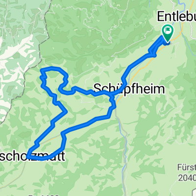
Hasle-Romoos-Holzwegen-Fontanne-Pintli
A cycling route starting in Hasle, Canton of Lucerne, Switzerland.
Overview
About this route
- 2 h 8 min
- Duration
- 34.2 km
- Distance
- 1,038 m
- Ascent
- 1,308 m
- Descent
- 16 km/h
- Avg. speed
- ---
- Avg. speed
Route quality
Waytypes & surfaces along the route
Waytypes
Quiet road
17.5 km
(51 %)
Road
16.1 km
(47 %)
Surfaces
Paved
16.1 km
(47 %)
Unpaved
0.3 km
(<1 %)
Asphalt
16 km
(47 %)
Gravel
0.3 km
(<1 %)
Continue with Bikemap
Use, edit, or download this cycling route
You would like to ride Hasle-Romoos-Holzwegen-Fontanne-Pintli or customize it for your own trip? Here is what you can do with this Bikemap route:
Free features
- Save this route as favorite or in collections
- Copy & plan your own version of this route
- Sync your route with Garmin or Wahoo
Premium features
Free trial for 3 days, or one-time payment. More about Bikemap Premium.
- Navigate this route on iOS & Android
- Export a GPX / KML file of this route
- Create your custom printout (try it for free)
- Download this route for offline navigation
Discover more Premium features.
Get Bikemap PremiumFrom our community
Other popular routes starting in Hasle
- Schimbrig-Runde
- Distance
- 19.1 km
- Ascent
- 653 m
- Descent
- 655 m
- Location
- Hasle, Canton of Lucerne, Switzerland
- Blau-Schwarz
- Distance
- 2,967.7 km
- Ascent
- 2,666 m
- Descent
- 3,590 m
- Location
- Hasle, Canton of Lucerne, Switzerland
- Schimbrig-First-Tour
- Distance
- 31.4 km
- Ascent
- 1,355 m
- Descent
- 1,285 m
- Location
- Hasle, Canton of Lucerne, Switzerland
- Hasle-Romoos-Holzwegen-Fontanne-Pintli
- Distance
- 34.2 km
- Ascent
- 1,038 m
- Descent
- 1,308 m
- Location
- Hasle, Canton of Lucerne, Switzerland
- BIKE Pia und Walter
- Distance
- 18 km
- Ascent
- 703 m
- Descent
- 285 m
- Location
- Hasle, Canton of Lucerne, Switzerland
- Moderate route in Hasle LU
- Distance
- 69.3 km
- Ascent
- 1,760 m
- Descent
- 1,773 m
- Location
- Hasle, Canton of Lucerne, Switzerland
- Hasle, Finishütte, Schimberg, Müllerenmoos,
- Distance
- 38.6 km
- Ascent
- 1,364 m
- Descent
- 1,364 m
- Location
- Hasle, Canton of Lucerne, Switzerland
- Napftour
- Distance
- 32.3 km
- Ascent
- 1,005 m
- Descent
- 1,005 m
- Location
- Hasle, Canton of Lucerne, Switzerland
Open it in the app