
後甲國中單車樂活南墾戶外教學之旅day1
A cycling route starting in Pingtung City, Taiwan, Taiwan.
Overview
About this route
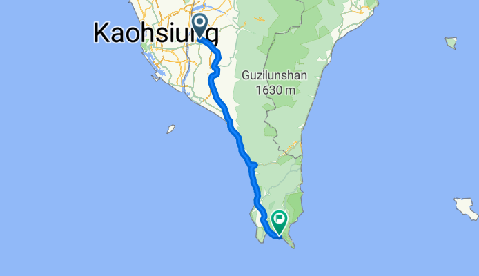
台南市立後甲國中→台南市火車站→屏東市火車站→民生路(台1線)→中山路(台1線)→麟洛→水底寮→枋山→楓港(台26線)→竹坑→車城→恆春→墾丁大街。
- -:--
- Duration
- 101.4 km
- Distance
- 116 m
- Ascent
- 124 m
- Descent
- ---
- Avg. speed
- ---
- Max. altitude

Continue with Bikemap
Use, edit, or download this cycling route
You would like to ride 後甲國中單車樂活南墾戶外教學之旅day1 or customize it for your own trip? Here is what you can do with this Bikemap route:
Free features
- Save this route as favorite or in collections
- Copy & plan your own version of this route
- Split it into stages to create a multi-day tour
- Sync your route with Garmin or Wahoo
Premium features
Free trial for 3 days, or one-time payment. More about Bikemap Premium.
- Navigate this route on iOS & Android
- Export a GPX / KML file of this route
- Create your custom printout (try it for free)
- Download this route for offline navigation
Discover more Premium features.
Get Bikemap PremiumFrom our community
Other popular routes starting in Pingtung City
 統嶺路 91之6, 大樹區 to 得勝巷, 旗山區
- Distance
- 14.3 km
- Ascent
- 471 m
- Descent
- 298 m
- Location
- Pingtung City, Taiwan, Taiwan
 2010.02.27 屏東 - 鵝鑾鼻 瘋300K
- Distance
- 304.6 km
- Ascent
- 803 m
- Descent
- 803 m
- Location
- Pingtung City, Taiwan, Taiwan
 2010-01-17 屏東瘋200
- Distance
- 193.5 km
- Ascent
- 935 m
- Descent
- 774 m
- Location
- Pingtung City, Taiwan, Taiwan
 三地門~~霧台
- Distance
- 18.8 km
- Ascent
- 1,096 m
- Descent
- 430 m
- Location
- Pingtung City, Taiwan, Taiwan
 110.03,14 泰武
- Distance
- 28.6 km
- Ascent
- 1,734 m
- Descent
- 1,889 m
- Location
- Pingtung City, Taiwan, Taiwan
 2012-02-25 瘋200K(2/24更新)
- Distance
- 197.4 km
- Ascent
- 373 m
- Descent
- 373 m
- Location
- Pingtung City, Taiwan, Taiwan
 北大武登山口
- Distance
- 23.1 km
- Ascent
- 1,639 m
- Descent
- 131 m
- Location
- Pingtung City, Taiwan, Taiwan
 逆風鐵馬團 - 中寮山50Km CLONED FROM ROUTE 178110
- Distance
- 49.1 km
- Ascent
- 609 m
- Descent
- 609 m
- Location
- Pingtung City, Taiwan, Taiwan
Open it in the app