

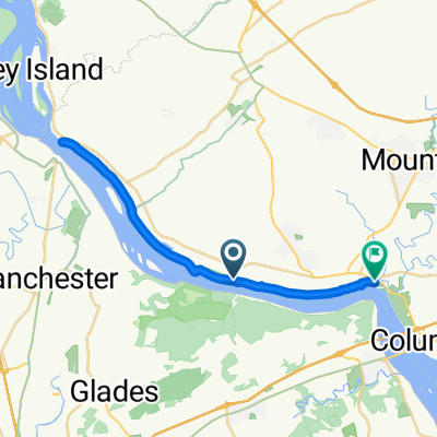
Vinegar Ferry Road, Marietta to Vinegar Ferry Road, Marietta
A cycling route starting in Maytown, Pennsylvania, United States.
Overview
About this route
- 1 h 47 min
- Duration
- 30 km
- Distance
- 77 m
- Ascent
- 79 m
- Descent
- 16.8 km/h
- Avg. speed
- ---
- Max. altitude
Route quality
Waytypes & surfaces along the route
Waytypes
Cycleway
27.3 km
(91 %)
Quiet road
1.4 km
(5 %)
Surfaces
Paved
25 km
(83 %)
Unpaved
3.3 km
(11 %)
Asphalt
20.9 km
(70 %)
Paved (undefined)
3.7 km
(12 %)
Continue with Bikemap
Use, edit, or download this cycling route
You would like to ride Vinegar Ferry Road, Marietta to Vinegar Ferry Road, Marietta or customize it for your own trip? Here is what you can do with this Bikemap route:
Free features
- Save this route as favorite or in collections
- Copy & plan your own version of this route
- Sync your route with Garmin or Wahoo
Premium features
Free trial for 3 days, or one-time payment. More about Bikemap Premium.
- Navigate this route on iOS & Android
- Export a GPX / KML file of this route
- Create your custom printout (try it for free)
- Download this route for offline navigation
Discover more Premium features.
Get Bikemap PremiumFrom our community
Other popular routes starting in Maytown
 Vinegar Ferry Rd, Marietta to Northwest River Trail, Marietta
- Distance
- 30.7 km
- Ascent
- 166 m
- Descent
- 169 m
- Location
- Maytown, Pennsylvania, United States
 Vinegar Ferry Road, Marietta to Vinegar Ferry Road, Marietta
- Distance
- 30 km
- Ascent
- 77 m
- Descent
- 79 m
- Location
- Maytown, Pennsylvania, United States
 Farm River MtJoy Columbia River
- Distance
- 51.7 km
- Ascent
- 289 m
- Descent
- 293 m
- Location
- Maytown, Pennsylvania, United States
 Sunday Ride
- Distance
- 18.7 km
- Ascent
- 145 m
- Descent
- 147 m
- Location
- Maytown, Pennsylvania, United States
 551 Vinegar Ferry Rd, Marietta to 551 Vinegar Ferry Rd, Marietta
- Distance
- 13 km
- Ascent
- 76 m
- Descent
- 77 m
- Location
- Maytown, Pennsylvania, United States
 Riding to cure
- Distance
- 4,780.9 km
- Ascent
- 4,961 m
- Descent
- 4,695 m
- Location
- Maytown, Pennsylvania, United States
 Vinegar Ferry Road, Marietta to Vinegar Ferry Road, Marietta
- Distance
- 21.5 km
- Ascent
- 95 m
- Descent
- 89 m
- Location
- Maytown, Pennsylvania, United States
 Northwest Lancaster County River Trail, Marietta to Vinegar Ferry Road, Marietta
- Distance
- 21.1 km
- Ascent
- 85 m
- Descent
- 87 m
- Location
- Maytown, Pennsylvania, United States
Open it in the app