

Bad Essen - Berge
A cycling route starting in Bad Essen, Lower Saxony, Germany.
Overview
About this route
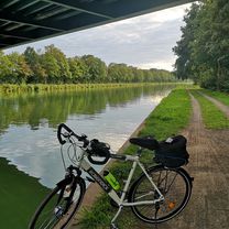
Sehr schöne Landschaft, teilweise duch Wald, viel Natur und wenig Verkehr.
- -:--
- Duration
- 26.3 km
- Distance
- 237 m
- Ascent
- 240 m
- Descent
- ---
- Avg. speed
- ---
- Max. altitude
Route quality
Waytypes & surfaces along the route
Waytypes
Quiet road
12.9 km
(49 %)
Road
5.1 km
(19 %)
Surfaces
Paved
16.2 km
(61 %)
Unpaved
0.9 km
(3 %)
Asphalt
13.8 km
(53 %)
Paving stones
1.8 km
(7 %)
Continue with Bikemap
Use, edit, or download this cycling route
You would like to ride Bad Essen - Berge or customize it for your own trip? Here is what you can do with this Bikemap route:
Free features
- Save this route as favorite or in collections
- Copy & plan your own version of this route
- Sync your route with Garmin or Wahoo
Premium features
Free trial for 3 days, or one-time payment. More about Bikemap Premium.
- Navigate this route on iOS & Android
- Export a GPX / KML file of this route
- Create your custom printout (try it for free)
- Download this route for offline navigation
Discover more Premium features.
Get Bikemap PremiumFrom our community
Other popular routes starting in Bad Essen
 Schlösser Tour - Bad Essen
- Distance
- 15.1 km
- Ascent
- 84 m
- Descent
- 74 m
- Location
- Bad Essen, Lower Saxony, Germany
 Hügeltour II.
- Distance
- 84.6 km
- Ascent
- 881 m
- Descent
- 879 m
- Location
- Bad Essen, Lower Saxony, Germany
 ZF-Strecke
- Distance
- 8.1 km
- Ascent
- 139 m
- Descent
- 79 m
- Location
- Bad Essen, Lower Saxony, Germany
 Bad Essen - Waldtour
- Distance
- 17.5 km
- Ascent
- 205 m
- Descent
- 226 m
- Location
- Bad Essen, Lower Saxony, Germany
 Senfdamm 28, Bad Essen nach Steinbrink 25, Bad Essen
- Distance
- 1.8 km
- Ascent
- 5 m
- Descent
- 8 m
- Location
- Bad Essen, Lower Saxony, Germany
 Auf den Spuren der Familie von Bussche (So, 07.07.2024)
- Distance
- 23 km
- Ascent
- 32 m
- Descent
- 31 m
- Location
- Bad Essen, Lower Saxony, Germany
 D008-RundUmBadEssen-43km
- Distance
- 42.9 km
- Ascent
- 269 m
- Descent
- 265 m
- Location
- Bad Essen, Lower Saxony, Germany
 Denkmalsweg 1, Bad Essen nach Wehrendorfer Bergstraße 4, Bad Essen
- Distance
- 32.5 km
- Ascent
- 372 m
- Descent
- 322 m
- Location
- Bad Essen, Lower Saxony, Germany
Open it in the app