

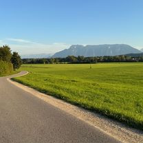
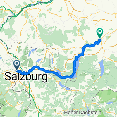
Tauernrunde
A cycling route starting in Freilassing, Bavaria, Germany.
Overview
About this route
- -:--
- Duration
- 306.3 km
- Distance
- 2,986 m
- Ascent
- 2,985 m
- Descent
- ---
- Avg. speed
- ---
- Max. altitude
Route quality
Waytypes & surfaces along the route
Waytypes
Quiet road
113.3 km
(37 %)
Track
52.1 km
(17 %)
Surfaces
Paved
223.6 km
(73 %)
Unpaved
42.9 km
(14 %)
Asphalt
220.5 km
(72 %)
Gravel
27.6 km
(9 %)
Route highlights
Points of interest along the route
Point of interest after 78.9 km
Villa Clothilde
Point of interest after 142 km
hotel
Point of interest after 203.6 km
Bahnhof
Point of interest after 244.9 km
hotel
Continue with Bikemap
Use, edit, or download this cycling route
You would like to ride Tauernrunde or customize it for your own trip? Here is what you can do with this Bikemap route:
Free features
- Save this route as favorite or in collections
- Copy & plan your own version of this route
- Split it into stages to create a multi-day tour
- Sync your route with Garmin or Wahoo
Premium features
Free trial for 3 days, or one-time payment. More about Bikemap Premium.
- Navigate this route on iOS & Android
- Export a GPX / KML file of this route
- Create your custom printout (try it for free)
- Download this route for offline navigation
Discover more Premium features.
Get Bikemap PremiumFrom our community
Other popular routes starting in Freilassing
 Ruhige Route
- Distance
- 30.1 km
- Ascent
- 323 m
- Descent
- 357 m
- Location
- Freilassing, Bavaria, Germany
 Abendrunde Freilassing - Surheim
- Distance
- 21 km
- Ascent
- 128 m
- Descent
- 128 m
- Location
- Freilassing, Bavaria, Germany
 Salzkammergut-Radtour (Tag 1)
- Distance
- 67.5 km
- Ascent
- 473 m
- Descent
- 353 m
- Location
- Freilassing, Bavaria, Germany
 Königsee-Bodensee-Radweg Teil 1 2014
- Distance
- 216.7 km
- Ascent
- 1,216 m
- Descent
- 857 m
- Location
- Freilassing, Bavaria, Germany
 Freilassing - Hochstaufenrunde
- Distance
- 65.5 km
- Ascent
- 836 m
- Descent
- 836 m
- Location
- Freilassing, Bavaria, Germany
 Freilassing - Winkelmoosalm
- Distance
- 121.1 km
- Ascent
- 1,382 m
- Descent
- 1,382 m
- Location
- Freilassing, Bavaria, Germany
 Freilassing Wasserburgerstr. nach Schwanenstadt
- Distance
- 111.9 km
- Ascent
- 729 m
- Descent
- 804 m
- Location
- Freilassing, Bavaria, Germany
 Waginger See 2
- Distance
- 65.8 km
- Ascent
- 621 m
- Descent
- 626 m
- Location
- Freilassing, Bavaria, Germany
Open it in the app