

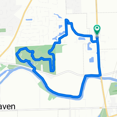
Rogue Tillman 32 Adams County Photo Op
A cycling route starting in New Haven, Indiana, United States.
Overview
About this route
Two miles into Adams County for "descpicalbe" photo op.
- -:--
- Duration
- 52.1 km
- Distance
- 33 m
- Ascent
- 35 m
- Descent
- ---
- Avg. speed
- ---
- Max. altitude
Route quality
Waytypes & surfaces along the route
Waytypes
Quiet road
27.5 km
(53 %)
Road
13.7 km
(26 %)
Surfaces
Paved
8.6 km
(17 %)
Paved (undefined)
7.7 km
(15 %)
Asphalt
1 km
(2 %)
Undefined
43.5 km
(83 %)
Continue with Bikemap
Use, edit, or download this cycling route
You would like to ride Rogue Tillman 32 Adams County Photo Op or customize it for your own trip? Here is what you can do with this Bikemap route:
Free features
- Save this route as favorite or in collections
- Copy & plan your own version of this route
- Sync your route with Garmin or Wahoo
Premium features
Free trial for 3 days, or one-time payment. More about Bikemap Premium.
- Navigate this route on iOS & Android
- Export a GPX / KML file of this route
- Create your custom printout (try it for free)
- Download this route for offline navigation
Discover more Premium features.
Get Bikemap PremiumFrom our community
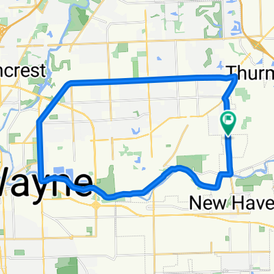
Other popular routes starting in New Haven
 Big Kreager Loop
- Distance
- 9.3 km
- Ascent
- 53 m
- Descent
- 20 m
- Location
- New Haven, Indiana, United States
 De Fairfield Avenue 6800, Fort Wayne a Oakmont Road 6121, Fort Wayne
- Distance
- 37 km
- Ascent
- 291 m
- Descent
- 280 m
- Location
- New Haven, Indiana, United States
 Rogue Tillman 25 Mostly N/S
- Distance
- 40.6 km
- Ascent
- 28 m
- Descent
- 27 m
- Location
- New Haven, Indiana, United States
 Rogue Tillman 32 Adams County Photo Op
- Distance
- 52.1 km
- Ascent
- 33 m
- Descent
- 35 m
- Location
- New Haven, Indiana, United States
 Rogue Tillman 31 Wayne Trace Flatrock Mill Thiele
- Distance
- 49.7 km
- Ascent
- 39 m
- Descent
- 38 m
- Location
- New Haven, Indiana, United States
 Rogue Tillman 28 County Line via Poe
- Distance
- 45.1 km
- Ascent
- 45 m
- Descent
- 46 m
- Location
- New Haven, Indiana, United States
 Stellhorn//Maumee
- Distance
- 27.6 km
- Ascent
- 48 m
- Descent
- 48 m
- Location
- New Haven, Indiana, United States
 Ride RMHC 2017 45-mile route
- Distance
- 72.7 km
- Ascent
- 19 m
- Descent
- 21 m
- Location
- New Haven, Indiana, United States
Open it in the app