
526. Kuventhal, Brockensicht und Sternhimmel
A cycling route starting in Einbeck, Lower Saxony, Germany.
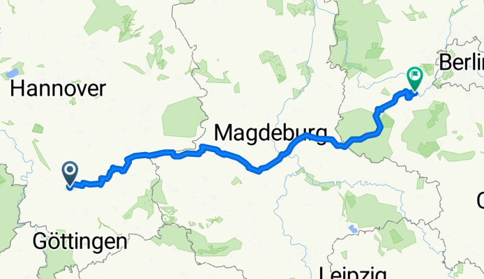
Overview
About this route
Part 2 MTT JupiQuitte | Gev-Wrd on Fri/Sat, 17/18.07.2020, 311 km, 13...24°C, mostly good wind (W to NW wind) problematic riding on the edge of the Harz (highways!), R1 Eurovelo route 8 km to Langelsheim poor quality (barely suitable for touring bikes, patches, gravel, crushed stone); Hamersleben-Hornhausen 6 km bad pavé with no edges • over 100 km of top views of the Brocken (roughly from Liebenburg to Biere) • very nice night ride with a superb starry sky in the Fläming
- -:--
- Duration
- 307 km
- Distance
- 505 m
- Ascent
- 604 m
- Descent
- ---
- Avg. speed
- ---
- Max. altitude
Route quality
Waytypes & surfaces along the route
Waytypes
Path
52.2 km
(17 %)
Quiet road
33.8 km
(11 %)
Surfaces
Paved
245.6 km
(80 %)
Unpaved
9.2 km
(3 %)
Asphalt
224.1 km
(73 %)
Concrete
18.4 km
(6 %)
Continue with Bikemap
Use, edit, or download this cycling route
You would like to ride 526. Kuventhal, Brockensicht und Sternhimmel or customize it for your own trip? Here is what you can do with this Bikemap route:
Free features
- Save this route as favorite or in collections
- Copy & plan your own version of this route
- Split it into stages to create a multi-day tour
- Sync your route with Garmin or Wahoo
Premium features
Free trial for 3 days, or one-time payment. More about Bikemap Premium.
- Navigate this route on iOS & Android
- Export a GPX / KML file of this route
- Create your custom printout (try it for free)
- Download this route for offline navigation
Discover more Premium features.
Get Bikemap PremiumFrom our community
Other popular routes starting in Einbeck
 adfcEinbeck Auf den Hoehen des Hils 20080803
- Distance
- 61.1 km
- Ascent
- 762 m
- Descent
- 658 m
- Location
- Einbeck, Lower Saxony, Germany
 Poldet-Buensen-Sdh 22.8.17
- Distance
- 29.4 km
- Ascent
- 162 m
- Descent
- 169 m
- Location
- Einbeck, Lower Saxony, Germany
 Umfahrung Baustelle Hullerser Landstraße Einbeck
- Distance
- 1.7 km
- Ascent
- 17 m
- Descent
- 5 m
- Location
- Einbeck, Lower Saxony, Germany
 20160918 Abendtour
- Distance
- 25.9 km
- Ascent
- 44 m
- Descent
- 231 m
- Location
- Einbeck, Lower Saxony, Germany
 Einbeck-Markoldendorf
- Distance
- 20.9 km
- Ascent
- 103 m
- Descent
- 104 m
- Location
- Einbeck, Lower Saxony, Germany
 RSCH Deutschlandtour 2009 - Etappe 5 von 5
- Distance
- 222.6 km
- Ascent
- 484 m
- Descent
- 574 m
- Location
- Einbeck, Lower Saxony, Germany
 EIN_KRE_EIN
- Distance
- 24.2 km
- Ascent
- 255 m
- Descent
- 253 m
- Location
- Einbeck, Lower Saxony, Germany
 04.LHR.Einbeck-Göt.
- Distance
- 89 km
- Ascent
- 401 m
- Descent
- 171 m
- Location
- Einbeck, Lower Saxony, Germany
Open it in the app