

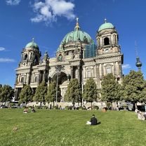
Berlin - Hamburg
A cycling route starting in Hansaviertel, State of Berlin, Germany.
Overview
About this route
- -:--
- Duration
- 283.2 km
- Distance
- 399 m
- Ascent
- 421 m
- Descent
- ---
- Avg. speed
- ---
- Max. altitude
Route highlights
Points of interest along the route
Point of interest after 0 km
Continue with Bikemap
Use, edit, or download this cycling route
You would like to ride Berlin - Hamburg or customize it for your own trip? Here is what you can do with this Bikemap route:
Free features
- Save this route as favorite or in collections
- Copy & plan your own version of this route
- Split it into stages to create a multi-day tour
- Sync your route with Garmin or Wahoo
Premium features
Free trial for 3 days, or one-time payment. More about Bikemap Premium.
- Navigate this route on iOS & Android
- Export a GPX / KML file of this route
- Create your custom printout (try it for free)
- Download this route for offline navigation
Discover more Premium features.
Get Bikemap PremiumFrom our community
Other popular routes starting in Hansaviertel
 Budapester Straße, Berlin nach Unter den Linden, Berlin
- Distance
- 8.9 km
- Ascent
- 70 m
- Descent
- 115 m
- Location
- Hansaviertel, State of Berlin, Germany
 Ku'damm - Havel Chaussee - P'dam - Spandau - Tegel
- Distance
- 81 km
- Ascent
- 250 m
- Descent
- 248 m
- Location
- Hansaviertel, State of Berlin, Germany
 Lichterfelde-Ost-RenaissanceTheater
- Distance
- 10.9 km
- Ascent
- 53 m
- Descent
- 51 m
- Location
- Hansaviertel, State of Berlin, Germany
 52.502, 13.338 nach 52.517, 13.389
- Distance
- 4.6 km
- Ascent
- 3 m
- Descent
- 3 m
- Location
- Hansaviertel, State of Berlin, Germany
 Berlin-Schiffsanleger
- Distance
- 10.9 km
- Ascent
- 66 m
- Descent
- 68 m
- Location
- Hansaviertel, State of Berlin, Germany
 Europa-Center-Neukölln
- Distance
- 11.5 km
- Ascent
- 61 m
- Descent
- 43 m
- Location
- Hansaviertel, State of Berlin, Germany
 B02_Berliner Mauertour
- Distance
- 35.2 km
- Ascent
- 68 m
- Descent
- 68 m
- Location
- Hansaviertel, State of Berlin, Germany
 Berlin-Tag02
- Distance
- 21.3 km
- Ascent
- 63 m
- Descent
- 77 m
- Location
- Hansaviertel, State of Berlin, Germany
Open it in the app