

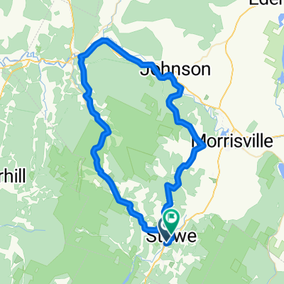
Overview
About this route
Notch + Lincoln Gap bagging. Pit stop at Warren Falls to cool off
- -:--
- Duration
- 171 km
- Distance
- 1,906 m
- Ascent
- 1,908 m
- Descent
- ---
- Avg. speed
- ---
- Max. altitude

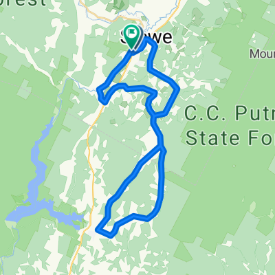
Part of
Stowe
9 stages
Route quality
Waytypes & surfaces along the route
Waytypes
Road
82.1 km
(48 %)
Quiet road
29.1 km
(17 %)
Surfaces
Paved
148.8 km
(87 %)
Unpaved
20.5 km
(12 %)
Asphalt
148.8 km
(87 %)
Gravel
20.5 km
(12 %)
Undefined
1.7 km
(1 %)
Continue with Bikemap
Use, edit, or download this cycling route
You would like to ride Notch + Lincoln Gap SEND or customize it for your own trip? Here is what you can do with this Bikemap route:
Free features
- Save this route as favorite or in collections
- Copy & plan your own version of this route
- Split it into stages to create a multi-day tour
- Sync your route with Garmin or Wahoo
Premium features
Free trial for 3 days, or one-time payment. More about Bikemap Premium.
- Navigate this route on iOS & Android
- Export a GPX / KML file of this route
- Create your custom printout (try it for free)
- Download this route for offline navigation
Discover more Premium features.
Get Bikemap PremiumFrom our community
Other popular routes starting in Morristown
 Stowe 50 Miler
- Distance
- 81.3 km
- Ascent
- 1,830 m
- Descent
- 1,824 m
- Location
- Morristown, Vermont, United States
 Notch Loop through HP
- Distance
- 70.2 km
- Ascent
- 822 m
- Descent
- 824 m
- Location
- Morristown, Vermont, United States
 Stowe_Capitol_Circuit_94km
- Distance
- 94.1 km
- Ascent
- 593 m
- Descent
- 592 m
- Location
- Morristown, Vermont, United States
 Autour de Stowe
- Distance
- 98.8 km
- Ascent
- 512 m
- Descent
- 512 m
- Location
- Morristown, Vermont, United States
 Route in Stowe
- Distance
- 71.5 km
- Ascent
- 1,495 m
- Descent
- 1,487 m
- Location
- Morristown, Vermont, United States
 Stowe Hollow Barnes Hill
- Distance
- 39.7 km
- Ascent
- 849 m
- Descent
- 845 m
- Location
- Morristown, Vermont, United States
 Sunset Rock + Hollow Rip
- Distance
- 12.4 km
- Ascent
- 309 m
- Descent
- 311 m
- Location
- Morristown, Vermont, United States
 Sterling Valley, Maple Run, Robinson Springs loop
- Distance
- 32.5 km
- Ascent
- 472 m
- Descent
- 472 m
- Location
- Morristown, Vermont, United States
Open it in the app