

Montchenis Haut Folin Arleuf Chateau Chinon Onlay Montchenis
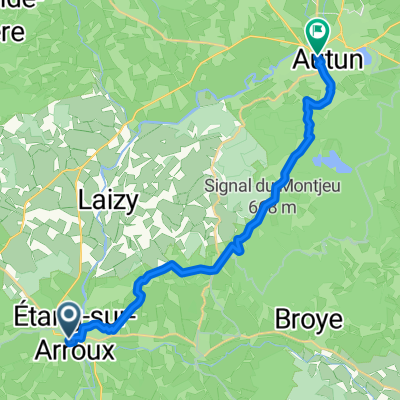
A cycling route starting in Étang-sur-Arroux, Bourgogne-Franche-Comté, France.
Overview
About this route
Tour with lonely roads and some elevation gain
- -:--
- Duration
- 86.9 km
- Distance
- 1,310 m
- Ascent
- 1,308 m
- Descent
- ---
- Avg. speed
- ---
- Max. altitude

Route quality
Waytypes & surfaces along the route
Waytypes
Road
33.9 km
(39 %)
Quiet road
22.6 km
(26 %)
Surfaces
Paved
36.5 km
(42 %)
Asphalt
36.5 km
(42 %)
Undefined
50.4 km
(58 %)
Continue with Bikemap
Use, edit, or download this cycling route
You would like to ride Montchenis Haut Folin Arleuf Chateau Chinon Onlay Montchenis or customize it for your own trip? Here is what you can do with this Bikemap route:
Free features
- Save this route as favorite or in collections
- Copy & plan your own version of this route
- Split it into stages to create a multi-day tour
- Sync your route with Garmin or Wahoo
Premium features
Free trial for 3 days, or one-time payment. More about Bikemap Premium.
- Navigate this route on iOS & Android
- Export a GPX / KML file of this route
- Create your custom printout (try it for free)
- Download this route for offline navigation
Discover more Premium features.
Get Bikemap PremiumFrom our community
Other popular routes starting in Étang-sur-Arroux
 Montchenis St Prix und zurück
- Distance
- 33.5 km
- Ascent
- 507 m
- Descent
- 508 m
- Location
- Étang-sur-Arroux, Bourgogne-Franche-Comté, France
 Haut Follin
- Distance
- 24.9 km
- Ascent
- 630 m
- Descent
- 630 m
- Location
- Étang-sur-Arroux, Bourgogne-Franche-Comté, France
 Haut follin
- Distance
- 25.4 km
- Ascent
- 699 m
- Descent
- 699 m
- Location
- Étang-sur-Arroux, Bourgogne-Franche-Comté, France
 Montchenis Fachin Glux en Glenne St Prix
- Distance
- 86.2 km
- Ascent
- 957 m
- Descent
- 940 m
- Location
- Étang-sur-Arroux, Bourgogne-Franche-Comté, France
 Tour um den Mont Beuvray
- Distance
- 55.3 km
- Ascent
- 892 m
- Descent
- 872 m
- Location
- Étang-sur-Arroux, Bourgogne-Franche-Comté, France
 Recovered Route
- Distance
- 5.3 km
- Ascent
- 96 m
- Descent
- 84 m
- Location
- Étang-sur-Arroux, Bourgogne-Franche-Comté, France
 From Étang-sur-Arroux to Autun
- Distance
- 18.1 km
- Ascent
- 412 m
- Descent
- 383 m
- Location
- Étang-sur-Arroux, Bourgogne-Franche-Comté, France
 Montchenis Haut Folin Arleuf Chateau Chinon Onlay Montchenis
- Distance
- 86.9 km
- Ascent
- 1,310 m
- Descent
- 1,308 m
- Location
- Étang-sur-Arroux, Bourgogne-Franche-Comté, France
Open it in the app